• Skip to primary navigation
  • Skip to main content
TAD Graphics logo

t ad studio | tad graphics

A vibrant, multi-disciplinary advertising, communications, creative and digital agency

  • About us
  • What we do
    • Creative and graphic design
    • Copywriting
    • Marketing and advertising
    • Promotional photography
    • Web design and digital media
  • Portfolio
  • Blog
  • Contact us
  • Shop prints

rail

Sacred Valley – the gateway to Machu Picchu

13 December 2019 by tadgraphics

The Sacred Valley was one of Inca's most important places
The Sacred Valley was one of Inca’s most important places

Peru’s southern highland provinces are so packed with the ruins of Inca civilisation that sometimes it feels you can’t go anywhere without stumbling across one. It is only by visiting them and seeing for yourself the sheer number of constructions and the skill that their builders possessed, that you can appreciate the advancement of the Inca civilisation. At its height, it covered as many territories as the Roman Empire, and despite their eventual defeat to the Spanish, you can’t help but feel that in terms of power and sophistication, they were close rivals to the Europeans of the time.
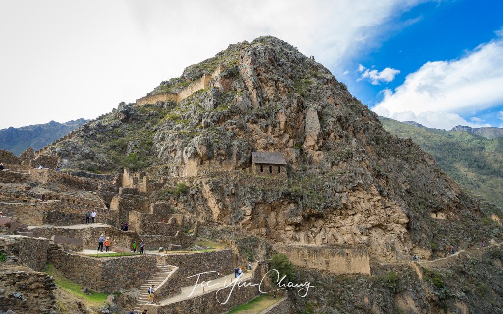
It is only by visiting and seeing for yourself the sheer number of constructions and the skill that their builders possessed, that you can appreciate the advancement of the Inca civilisation. This is Ollantaytambo Ruins

We had just taken in Cusco, their empire’s capital, and were planning to make our way to Machu Picchu. It was tempting to head straight there, but between these two sites is a place nobody should miss. The Sacred Valley of Urubamba was one of the Inca’s most important places and, as such, it has a particularly high number of impressive ruins. We decided to take a day taking in the sites of the valley.
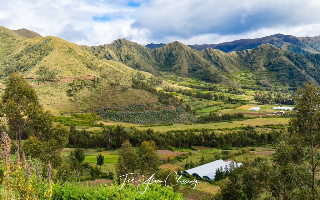
Pisac is located at a strategic position at the head of the Sacred Valley

This valley was important to the Incas, not just because of its proximity to their capital, but also due to the relatively lower altitude. In a place as high up as this part of Peru, this is a rarity. Because of this, the valley could be farmed more intensively than elsewhere, and corn, an uncommon and important status food for the Inca elites, could thrive. Its fertility was aided by the Urubamba River which flows along the valley floor. As the valley grew in importance, several towns sprung up and the valley became one of the favoured retreats for the elites and the emperor himself. The rich and powerful started to build large estates for themselves, so that they could escape from the city to relax from time-to-time.
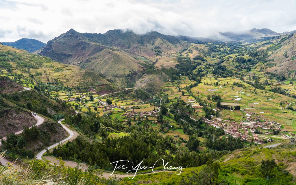
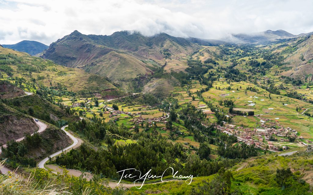
View of Pisac town from the archaeological park

Our first stop was Pisac, located at a strategic position at the head of the Sacred Valley. The small town of Pisac is still inhabited by the Quechua speaking descendants of the Inca. During the height of their ancestor’s empire however, it was a thriving town, so large that its remains are spread out across four separate complexes.
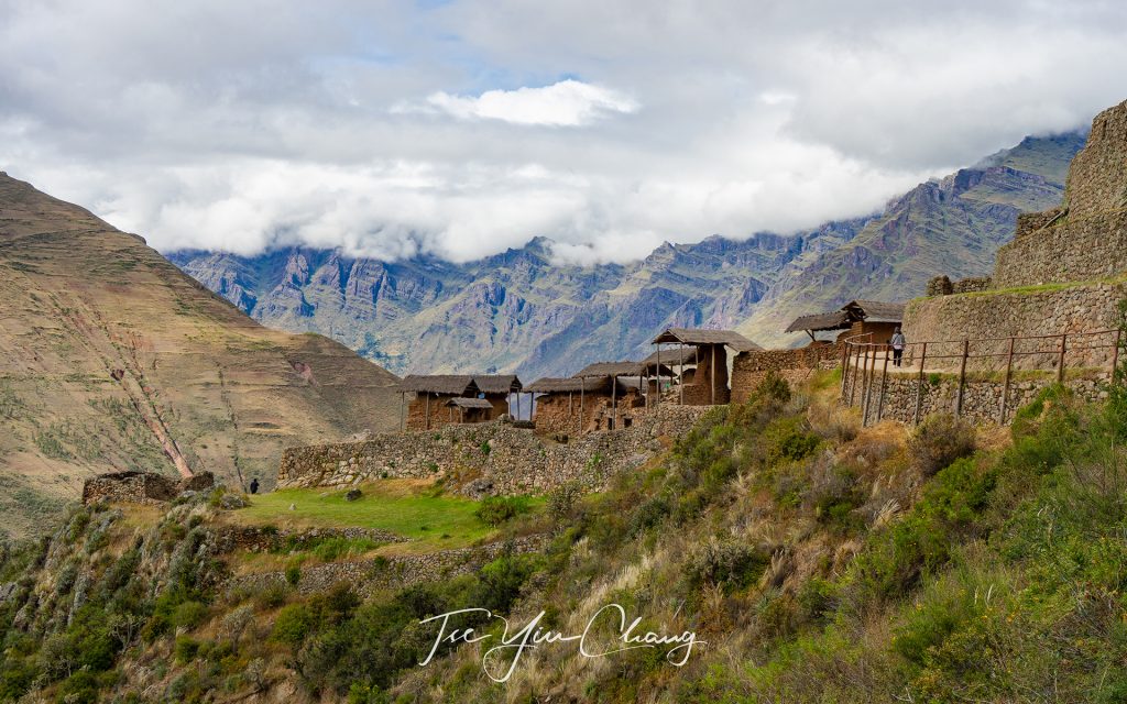
Kinchuraqay, perched precariously on the side of the hill, were grain stores where precious corn was kept

Pisac’s main purpose was to guard the southern end of the valley, protecting both its precious agricultural land, and the heartland around Cusco from invaders. It is theorised that the main threat were the Asháninka people who lived down in the jungle on the eastern foothills of the Andes. These people resisted Inca conquest fiercely and may have launched raids up into the mountains.
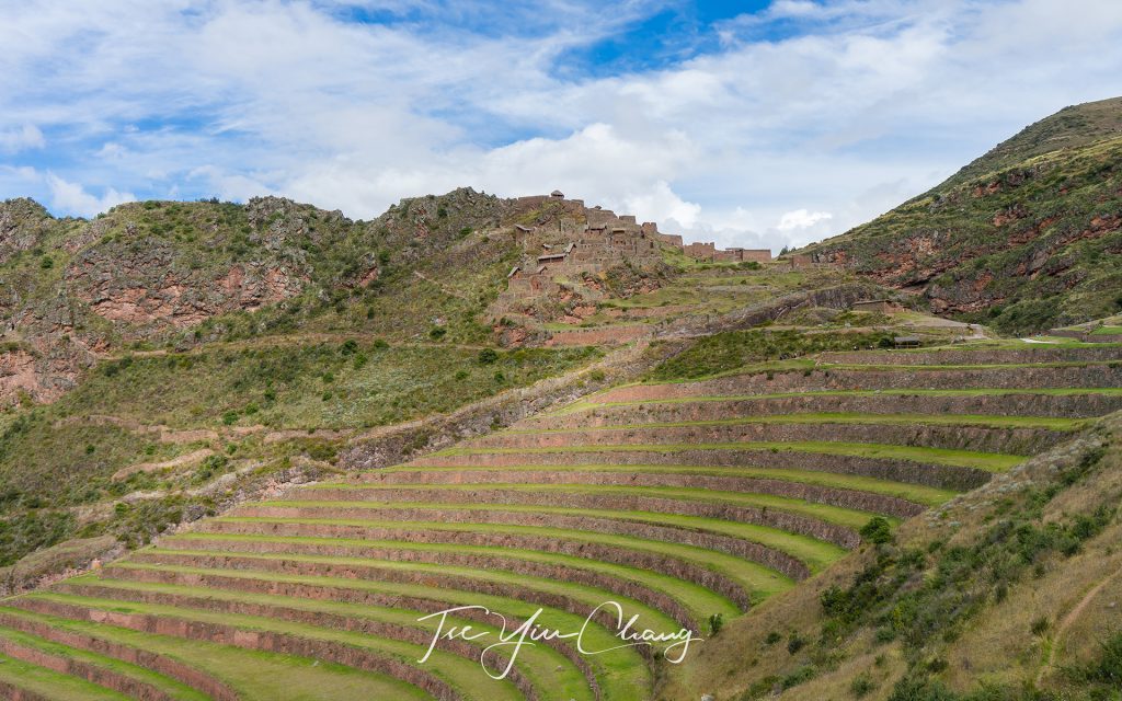
The Inca carved out dramatic terraces from the hillside to be used for agriculture, you can see Intihuatana sun temple at a distance

Pisac’s main attractions can be found up in the hills overlooking the village from the north. The first site we visited was Intihuatana – the sun temple. Inti was the favourite god of the Inca and he was associated with the sun. Here the name refers to the temple as a whole, but there are many Intihuatanas in Peru, and usually they take the form of a sacred stone which, when combined with the light of the sun, functioned as a type of clock or calendar. This one aligns with the sun during the June solstice, and within the temple there, is also an altar and a sacred spring. The temple is another fine example of the famous Inca stonework on display. Its location high up on the ridge gives it commanding views of the valley below.
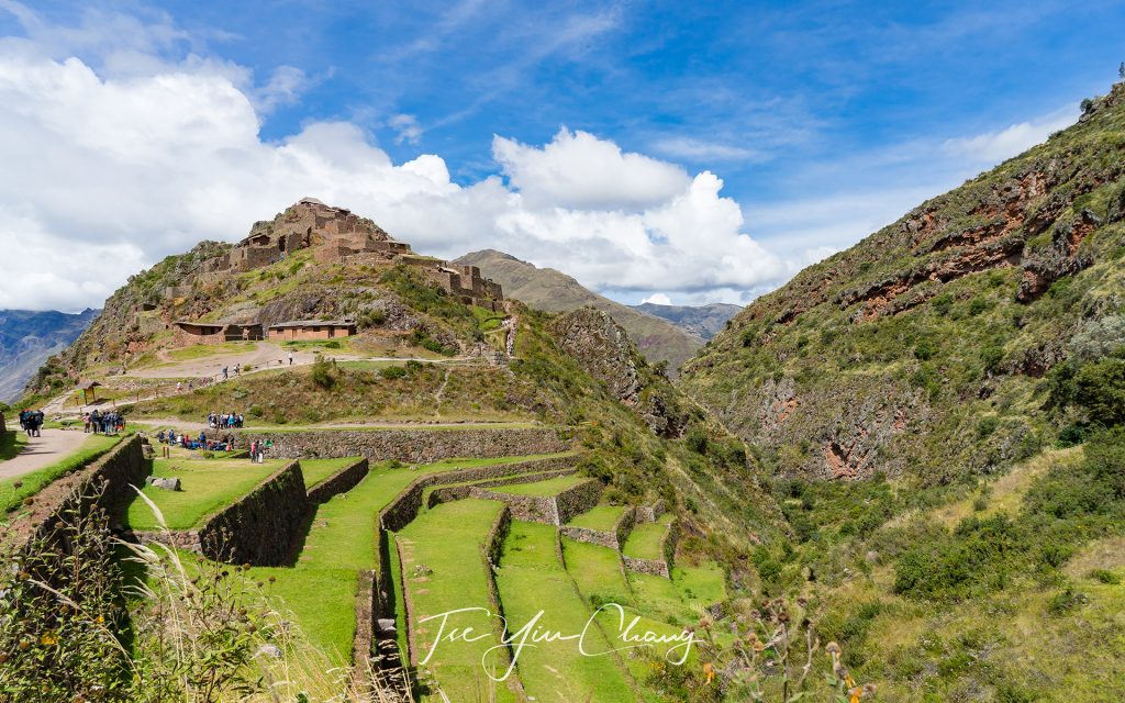
Agriculture terraces and Intihuatana - the sun temple. Pisac is one of Peru's biggest archeological site
Agriculture terraces and Intihuatana – the sun temple. Pisac is one of Peru’s biggest archeological site

A little further down the slope is Q’allaquasa. This was the main Inca settlement where the majority of the ruins are of the houses which were occupied by the settlement’s ordinary inhabitants. Despite not being grand constructions, they are still impressive thanks to their position on the crown of a hill. To maximise the land available for agriculture, the Inca carved out dramatic terraces from the hillside, reminiscent of those in Eastern Asia. These still exist today, and some of the most impressive surrounding Q’allaquasa.
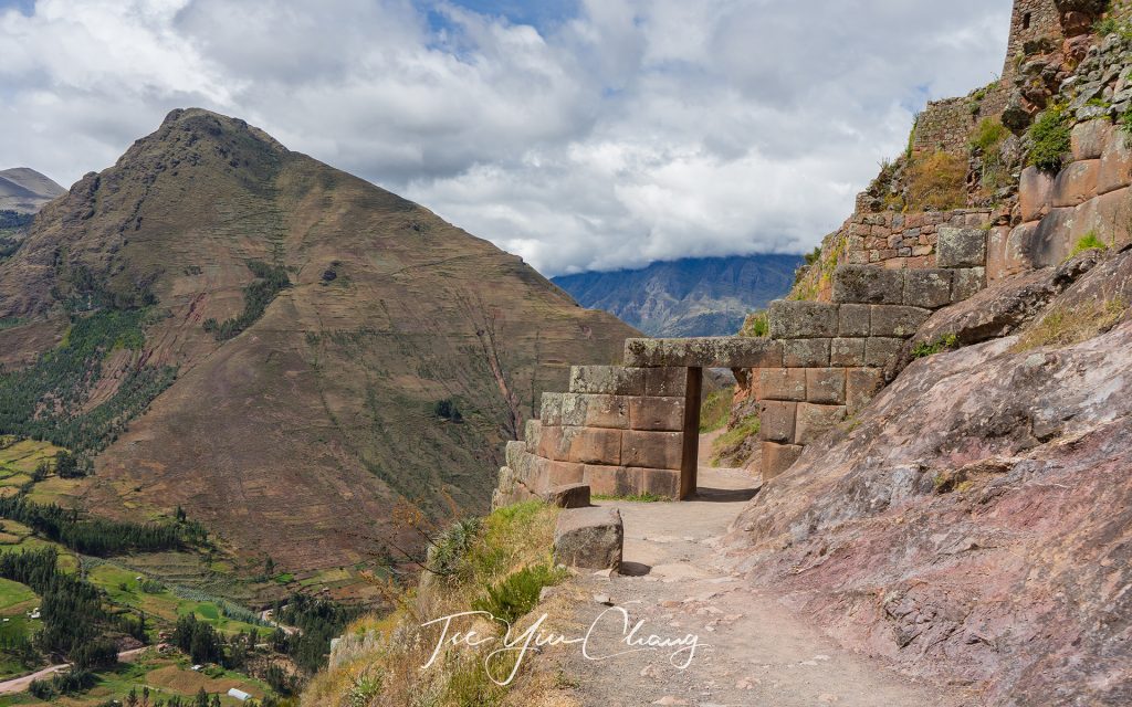
Inca doorway, marking the entrance to the sun temple

The final site we saw at Pisac was Kinchiraqay. Perched precariously on the side of the hill, these red stone buildings were the grain stores where precious corn was kept. Stacked one on top of the other, their charm is completed by the sloping thatched roofs, and as with almost every site in the Sacred Valley, the sweeping views their position gives.
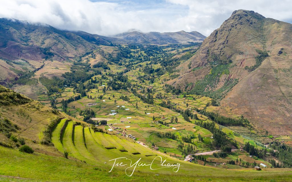
Pisac is an important argricultural hub due to its climate and fertile soil

We moved on towards the town of Urubamba for lunch. Urubamba is one of the larger towns in the valley with a population of less than 3,000. It is situated at a spot where the valley opens up and provides enough space for a town, as well as for agriculture. On our way there we were treated to more of the valley’s striking scenery. Following the river along the valley floor, we were treated to an endless procession of pastoral fields bounded by towering peaks.
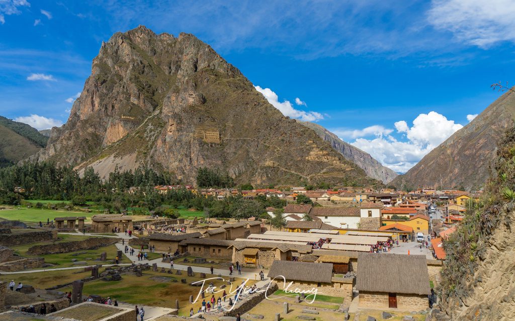
View of Ollantaytamboo old town from the ruins

After lunch we continued up the valley until we reached the region’s other major set of ruins. Just as Pisac guards the southern entrance to the valley, Ollantaytambo, also known as Ollanta by the locals, was designed to stop potential attacks from the north. The site was occupied long before the Inca arrived, however it was Pachacuti, considered as the most successful Inca emperor, who really transformed it into a significant place. He decided to set it aside as his personal estate after he had brought it into the empire.
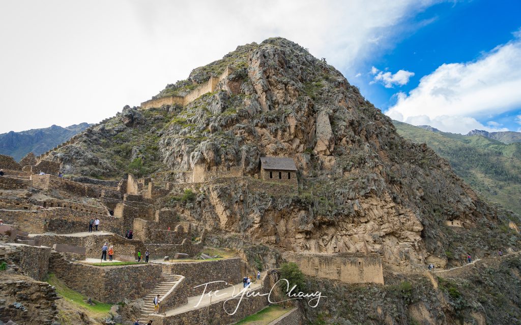
The well-preserved Ollantaytamboo was once a stronghold of Inca resistance to Spanish colonisation

Here he constructed temples, defences and agricultural terraces, prompting the development of a town to house the workers of his estate. That town was largely demolished by the Spanish, but the rest of Pachacuti’s work has been preserved, albeit in ruined form. It is not hard to picture how grand this place must have been, despite its abandoned state.
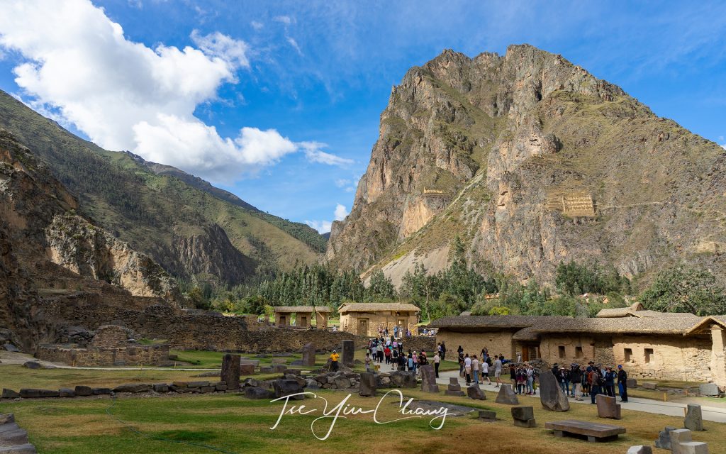
Ollantaytamboo looking across to Pinkuylluna mountain (right). If you look closer you will see the face of Wiracocha carved into the rocks. The Incas believed he was the creator of all. Next to it you can see the Pinkuylluna Incan storehouses, used to store agricultural crops to feed the town

The famous and impressive Inca stonework is on display everywhere, and some buildings are almost complete, apart from a lack of roofs. Structures like the wall of the six monoliths, which forms part of the temple complex, demonstrate the highly developed engineering skills that the Inca possessed. Built from stones weighing more than fifty tonnes each, it’s a mystery how they managed to drag them up to this inaccessible spot. Archaeologists believe that the temple was never actually finished, and it is thought that Ollantaytambo was in the midst of a renovation when the Spanish turned up and terminated the construction.
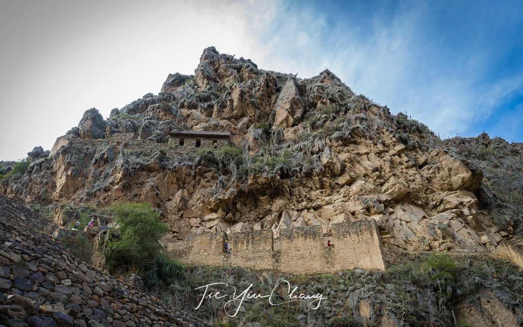
Another example of the famous and impressive Inca stonework on display at Ollantaytamboo

Clearly its defences turned out to be of no use against the Europeans, but that doesn’t mean that they were not formidable. Smaller fortifications dot the hills around the main site (as do grain storehouses and quarries from which the building stone was obtained), and the Inca even diverted a stretch of the river so that it ran across the valley floor rather than along it. This gave invaders another obstacle to navigate. Like at Pisac, the hills leading up to the ruins have been extensively modified to create stepped terraces, and while those at Pisac are bigger, these are unquestionably neater.
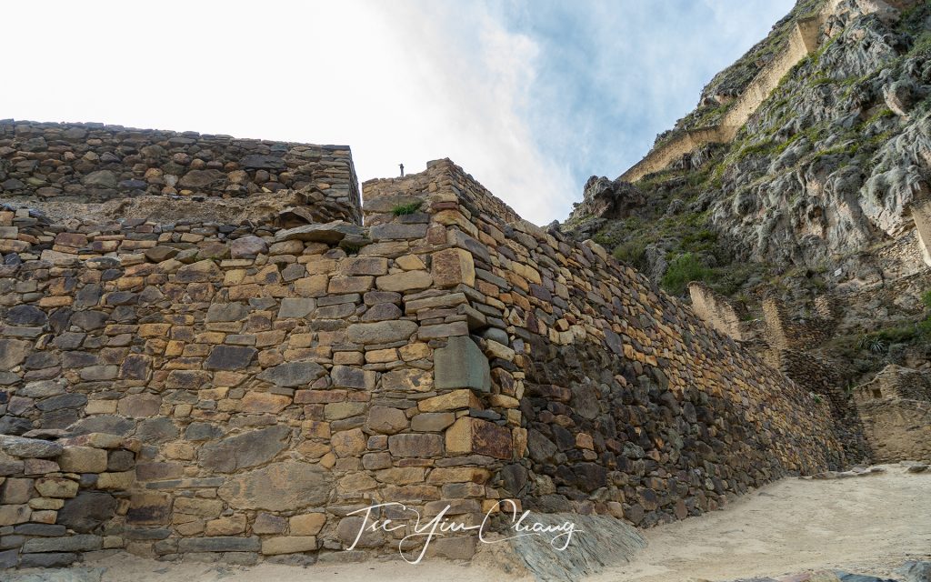
The Incas possessed highly developed engineering skills

We were dropped at the Ollantaytambo Station in the afternoon and boarded the train to Aguas Calientes. If it wasn’t for the fact that this is the closest settlement to Machu Picchu, this town would be of little importance, hidden away between the towering mountains. Much of the town has been given over to the tourism industry, and its streets are packed with visitors.
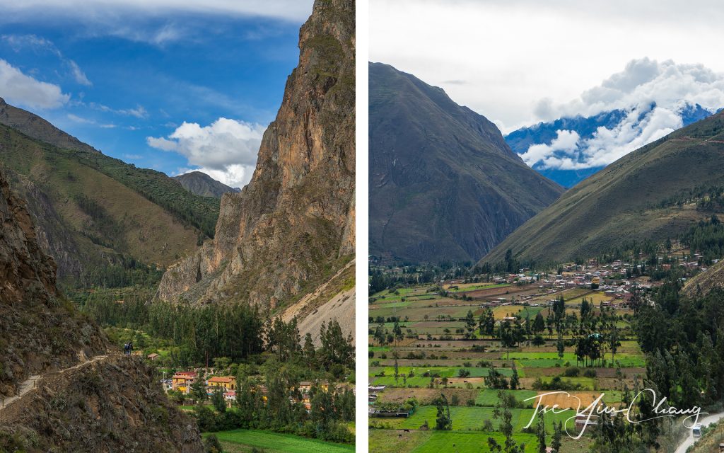
Ollantaytamboo is the beginning of the Inca Trail to Machu Picchu

While the landscapes of the Sacred Valley are spectacular, Aguas Calientes is further up into the Andes, and, its setting is even more dramatic. The slopes are like walls, and the flat space beside the river where buildings can be constructed is limited. The result is a small, but bustling town, wedged improbably into every available bit of space. It was a pleasant enough place to spend the night, but like everyone else there we were more excited about what tomorrow had in store for us – the ruins of Machu Picchu.
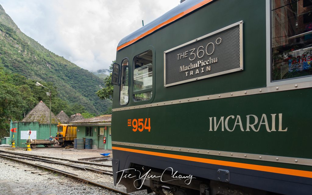
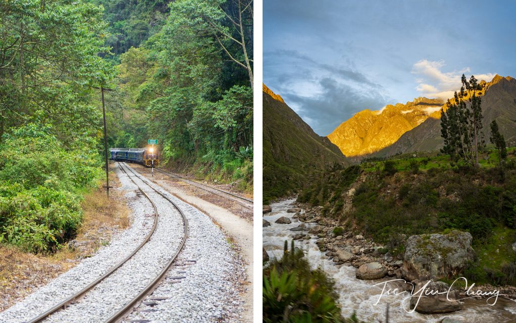
The scenic IncaRail 360o Machu Picchu Train has an observation outdoor carriage for travellers to admire the Andean landscape

See also:

  • A journey through the picturesque Andes by rail
  • Exploring the capital of the Inca Empire – Cusco
The IncaRail 360o Machu Picchu Train is one of the most panoramic journey in Latin America
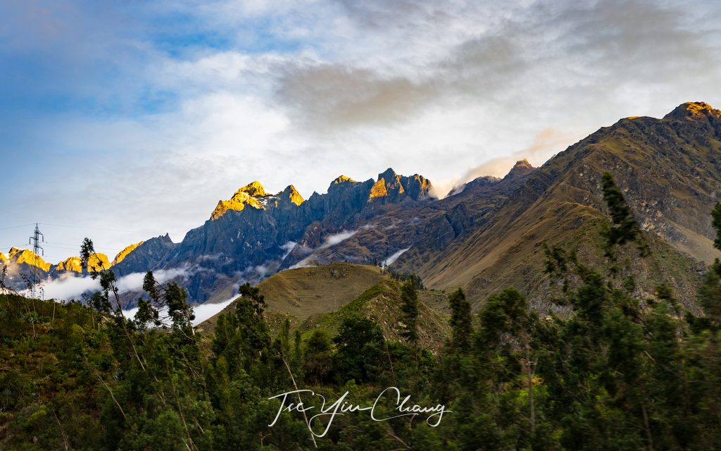
There were still snow on top of the mountains
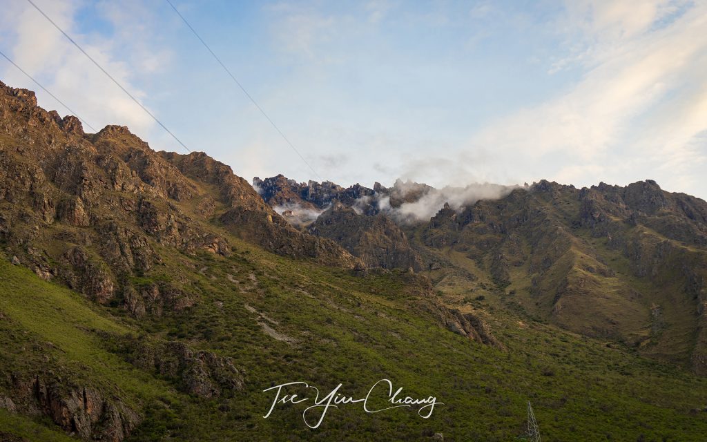
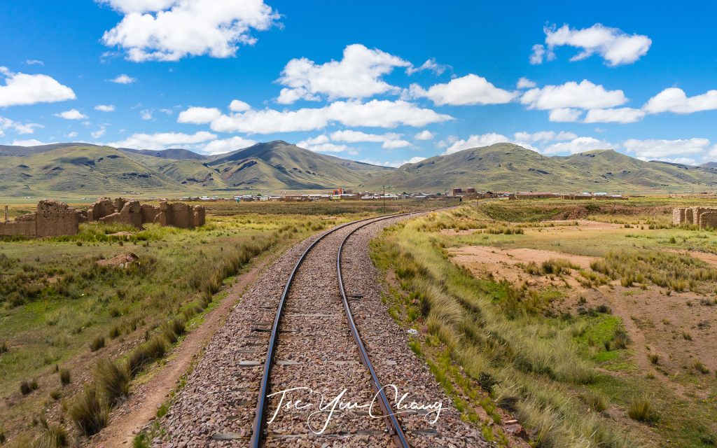
Dramatic and spectacular Andean landscape along the train journey to Machu Picchu

Filed Under: Blog, Photography, Portfolio, Travel Tagged With: adventure, altitude, inca, machu picchu, ollantaytambo, peru, pisac, rail, sacred valley, south america, spring, UNESCO, urubamba

A journey through the picturesque Andes by rail

24 October 2019 by tadgraphics

Picturesque Andes is the world’s longest and second highest mountain range

The Andes are, without question, among the most dramatic places on earth. Stretching like a spine from the southern tip of the South American continent all the way to Colombia in its very north, they are the world’s longest and its second highest mountain range. Sitting right in the centre of the range – and encompassing some of its finest scenery – is Peru. There are many ways to travel around the country and take some of its marvellous landscapes in, but one of the best is the PeruRail train between two of the country’s most famous sites – Lake Titicaca and Cusco.

The pristine Lake Titicaca is the world’s highest navigable body of water, sitting at 3,800 metres above sea level

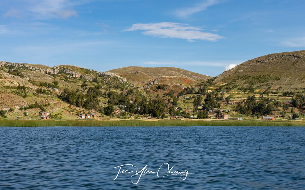
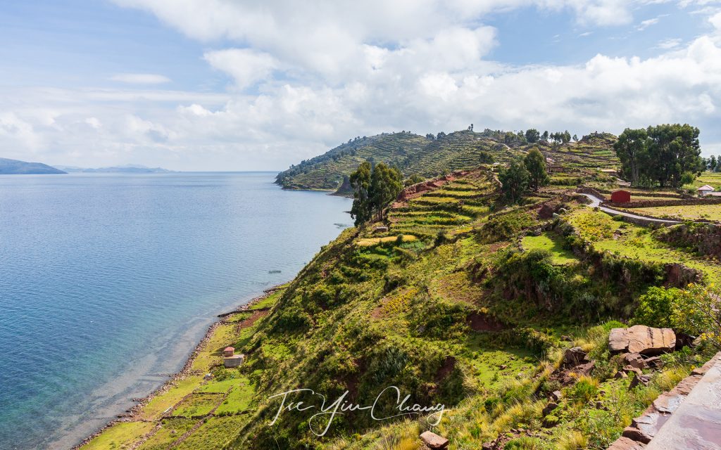
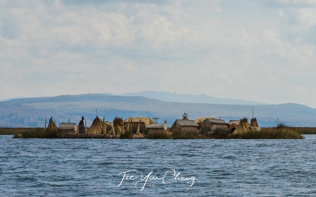
Lake Titicaca is the world’s highest navigable body of water, sitting at 3,800 metres above sea level. It is a place of desolate windswept beauty; a place where rocky slopes cloaked in yellow grass give way to pristine blue water and swaying reeds. In the distance are snow-capped mountains, and on the lake itself the indigenous people, also known as Uros build floating islands on which they live.

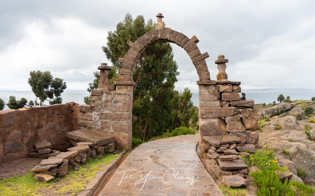
Visitors must hike along the pre-Inca Taquile Island trail and pass through the gate before arriving at the village

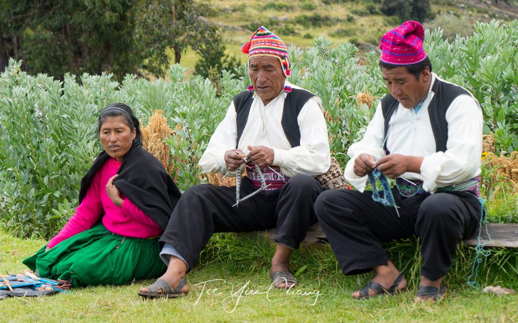
The pristine blue waters of Lake Titicaca hide a tourist gem, the scenic, tranquil and culturally rich Taquile Island. The island’s people, the self-sustaining Taquileños still speak Quechua, the ancient language of the Inca. The island is only accessible by boat. Once the boat docks on the cove, there is a short hike along a pre-Inca trail overlooking spectacular landscapes of the island. Taquile is known for producing some of Peru’s finest quality textiles and clothing. These delicately hand-knitted crafts is an activity exclusively reserved for men, a tradition practiced since the time of the Incas. Taquile’s hand-knitted textiles are considered so unique that they were named Masterpieces of the Oral and Intangible Heritage of Humanity by UNESCO in 2005.

Taquileño knitting men, a tradition practiced since the time of the Incas

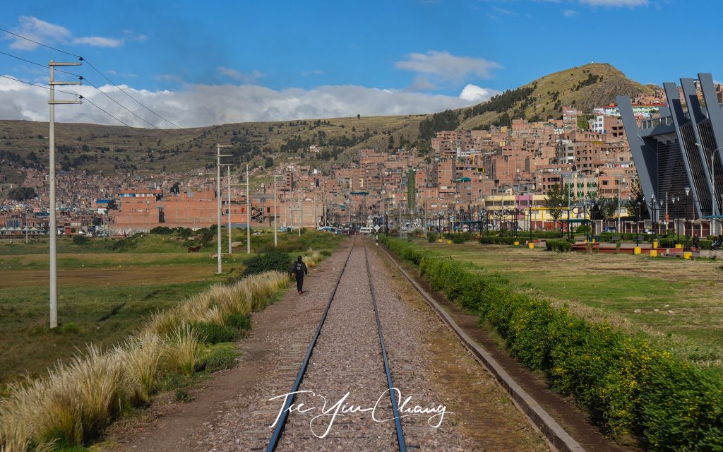
The lake straddles the border between Peru and Bolivia, and the town of Puno is the most popular base for travellers on the Peruvian side. From here, visitors can take trips out onto the lake, or visit some of the nearby pre-Hispanic ruins. The town itself possesses a few attractive colonial buildings and all this makes it a good place to spend a few days. It is from here that the PeruRail train leaves.

Town of Puno possesses a few attractive colonial buildings

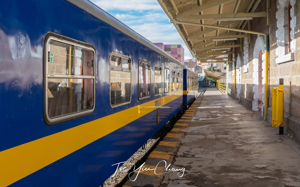
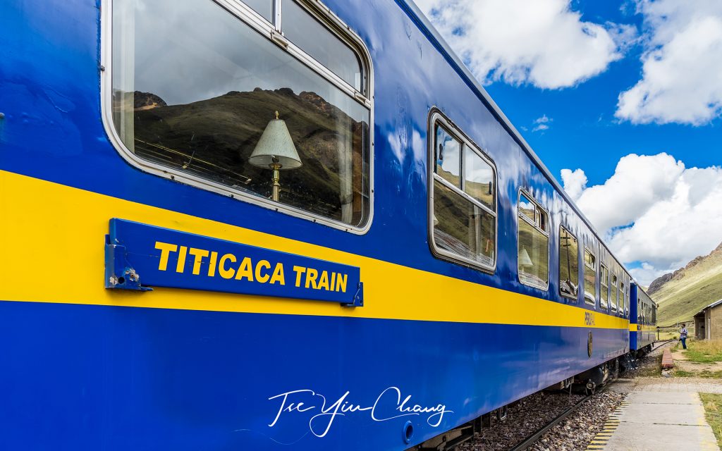
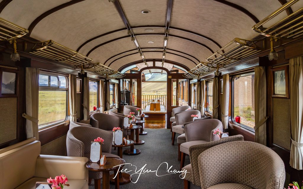
There are still working trains in Peru which are used for day-to-day transport and for moving goods around the country. This train, however, is not one of them. It exists solely to provide travellers with a memorable experience, and for this reason, is a lot more comfortable and grander than your average commuter train. The interiors of the carriages are all wooden panelling, dimmed yellow lighting and white tablecloths. It feels like something from the golden age of rail travel, not something that you immediately associate with Peru, but a welcome feature nonetheless.

PeruRail Titicaca train departing Puno

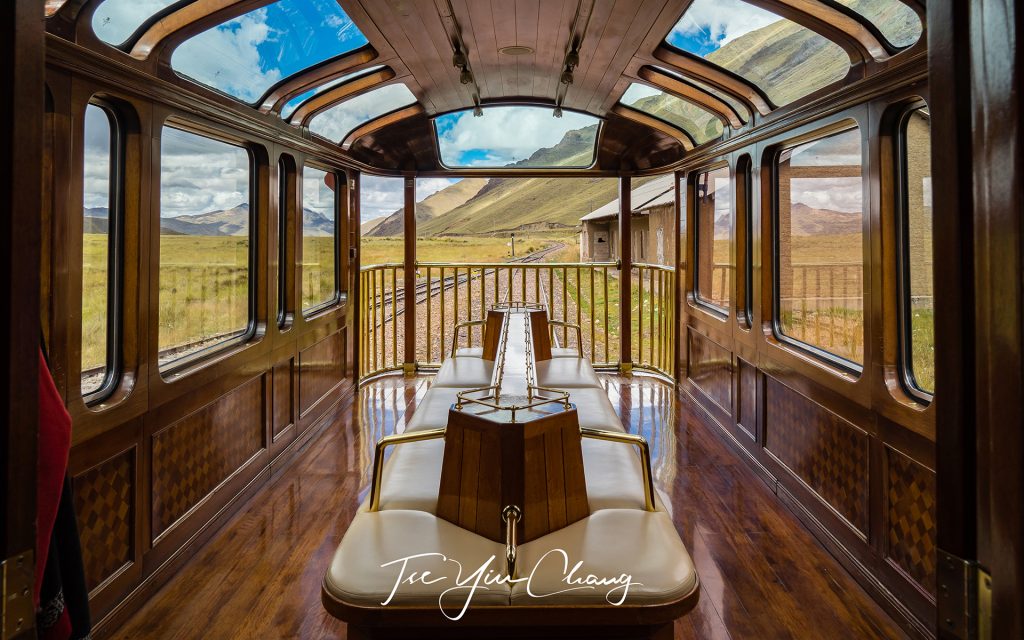
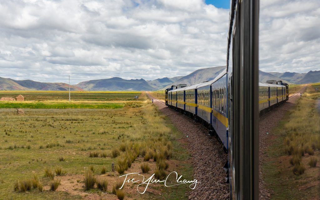
Everything else about the journey, however, is designed to highlight what a spectacular and culturally rich country Peru is. You can walk freely between the dining carriages and the observation car, which has been fitted out with glass. Its windows extend across the roof to show off the big blue skies, and the rear of the car opens up into a balcony. 

Peru is blessed with a huge variety of dramatic scenery

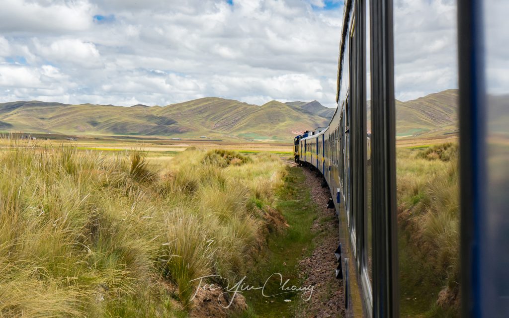
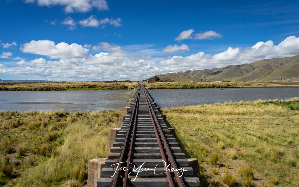
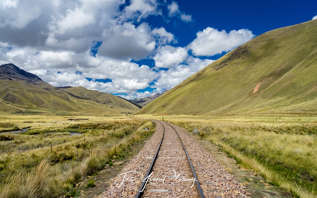
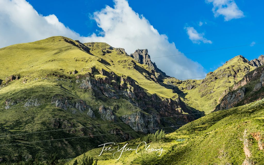
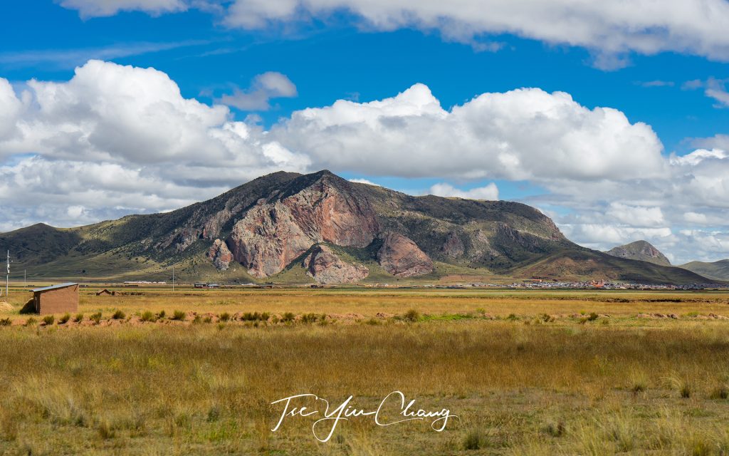
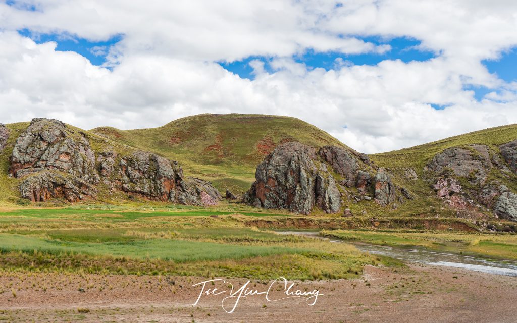
Peru is blessed with a huge variety of dramatic scenery, with everything from Amazon rainforests to one of the driest dessert on earth. The part of the country which the train travels through is known as the altiplano, and it alternates between sweeping open high altitude plains and jagged mountain peaks. Through the windows on one side, you might see empty grassland populated with only the occasional llama herd, while on the other, dramatic white peaks loom, casting their shadow over the train.

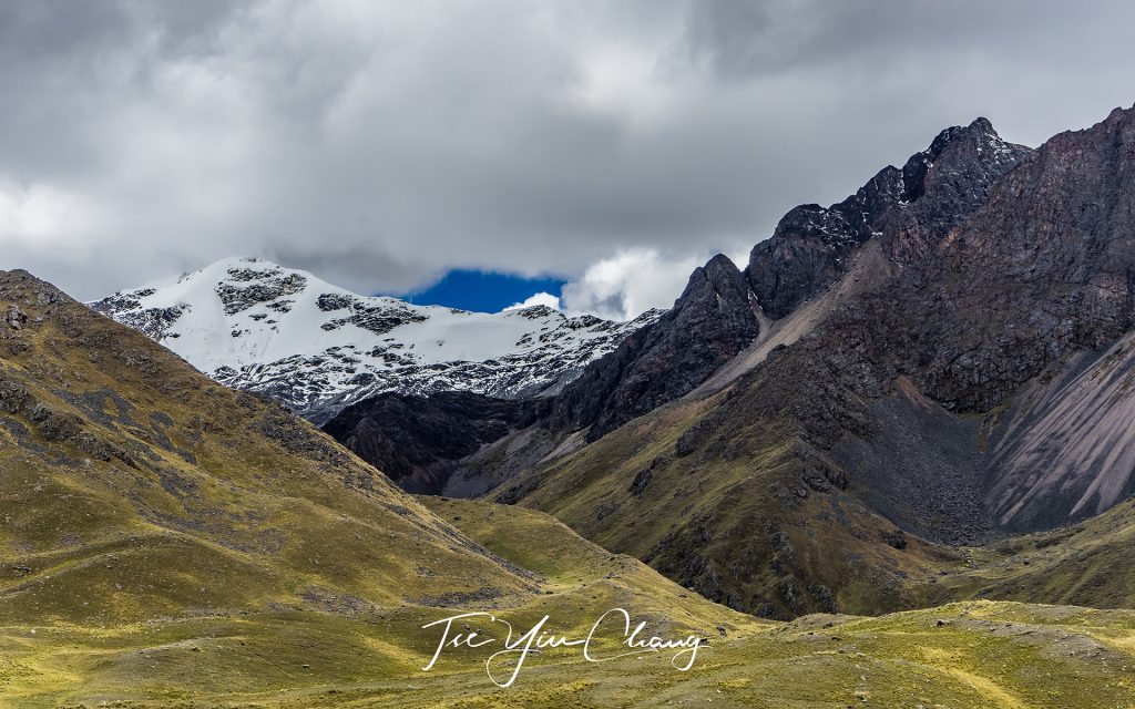
Dramatic white peaks of the Andes

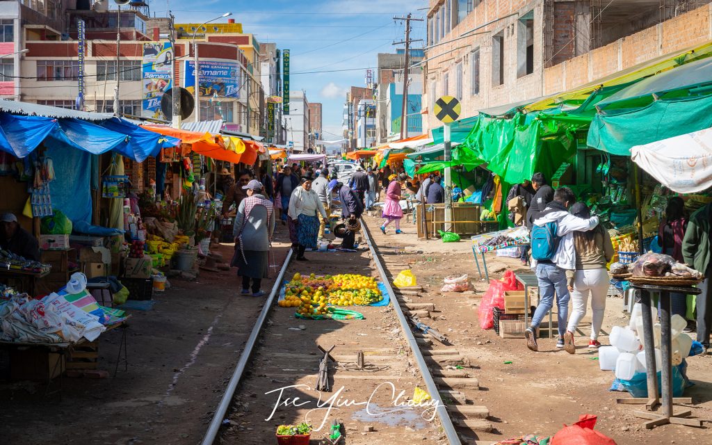
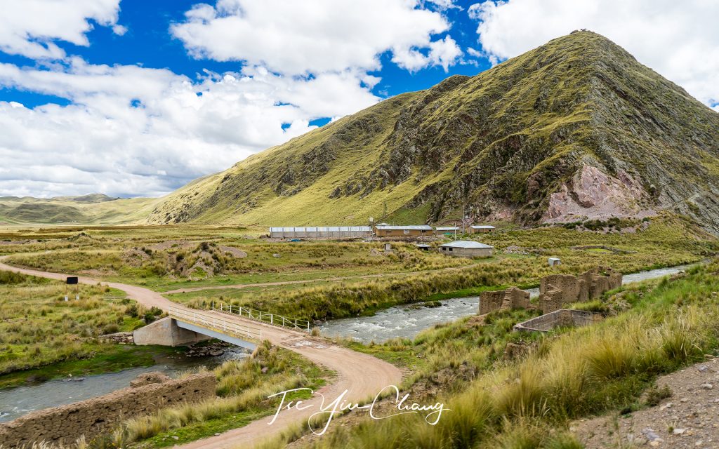
It feels impossibly lonely up here, but every now and again you are surprised by the sight of a tiny village rolling into view or someone walking alone across the empty landscape. The train passes through a few larger towns, and one of the most interesting comes soon after departing Puno. Juliaca is not the sort of place visitors would usually stop, however, passing through by train gives a fascinating glimpse of everyday life in the Peruvian Andes. The tracks cut right through the middle of the town market, with the stalls passing within touching distance. Locals go about their business, haggling for everything from food to building supplies, and children wave at you as they wait for the train to pass so they can cross the tracks. This is a slice of Peru at its most authentic.

A fascinating glimpse of everyday life of the Peruvian Andes as the train tracks cut right through the middle of the Juliaca town market, with the stalls passing within touching distance

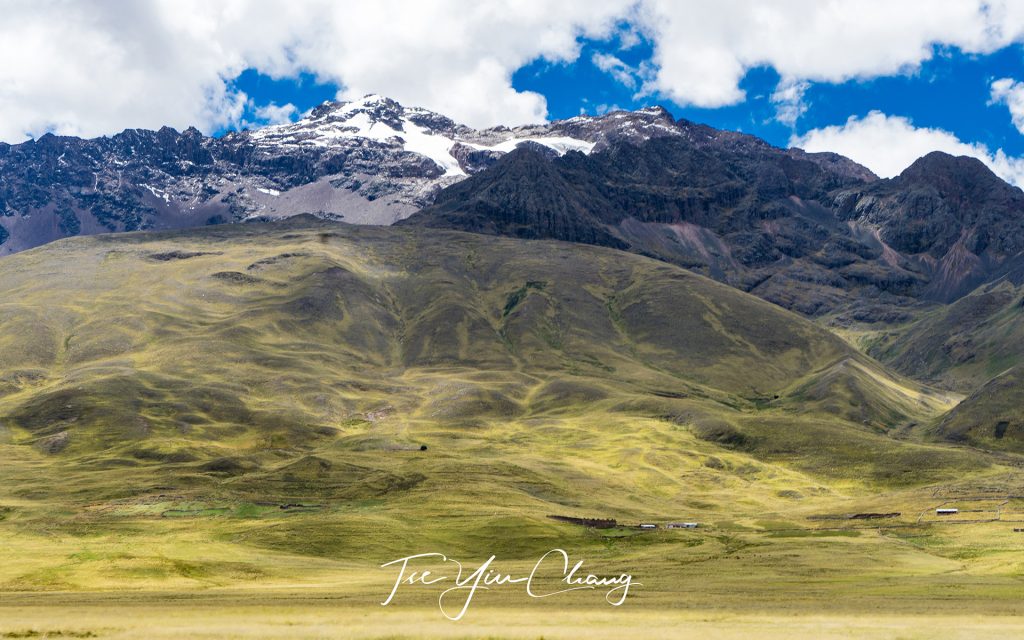
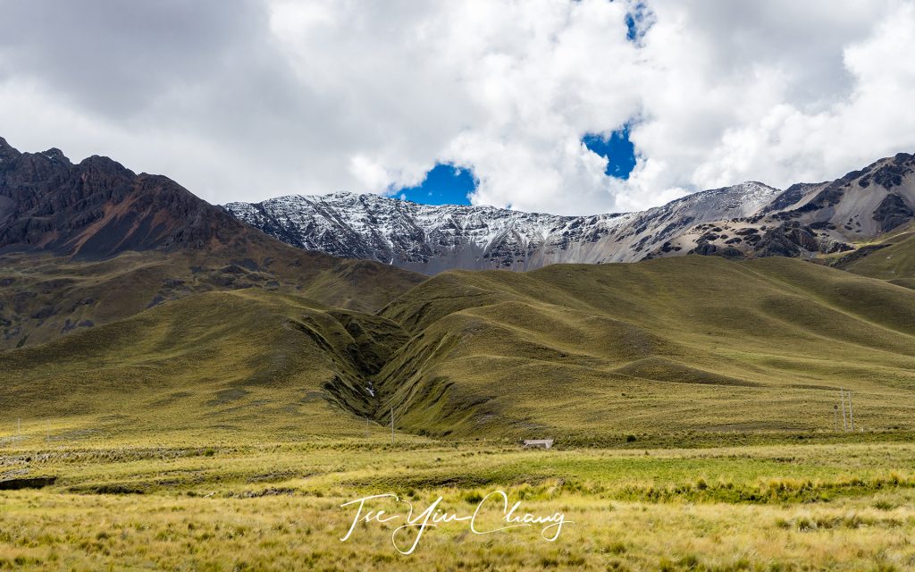
Around halfway along, the train reaches its highest point, the pass at La Raya – a rare opening in the surrounding mountains which allows the track to cut through. At 4,319 metres above sea level and hemmed in by peaks, it’s hard to believe that this place would be inhabited if it wasn’t for the passing trains. Inhabited it is however (just about), and it is here that the train makes its only stop. It is worth using some of the time to peruse the small handicraft market, and some more to step inside the small chapel. Once you have done that, you have seen everything manmade that La Raya has to offer. The best thing about the stop, however, is the chance to step out into the spectacular scenery you have been passing, and spend some time taking it all in.

Spectacular snow-capped mountains at La Raya. This cold and remote village is the highest point of the Lake Titicaca-Cusco route which is located at 4,319 metres above sea level

Peruvian culture is not just on display outside the train, you can experience it up close thanks to the entertainment included as part of the ticket. Passengers are serenaded by a band made up of guitars, tiple, flute, percussion and of course pan pipes. The haunting Andean melodies make a perfect addition to the landscapes rolling past outside. The indigenous culture of the altiplano is particularly colourful, and it is on full display in the dress and movement of the dancers who accompany the music.

The beautiful train is furnished with 1920s-style Pullman carriages. The open-air observation carriage is a dream for photographers keen to capture the dramatic scenery of the Peruvian Andes

After ten hours the train reaches Cusco, its final destination. If you visit Peru, the chances are you will end up in Cusco at some point. It is the starting point for visits to the famous Machu Picchu and the Sacred Valley, two of the country’s world famous attractions. The city itself was once the capital of the Inca Empire and later became an important colonial town for the Spanish. They built their opulent mansions, cathedrals and plazas right on top of the existing city, resulting in a unique hybrid architecture. Inca walls made from enormous stone blocks – somehow fitting together perfectly without the need for cement – sit next to whitewashed Iberian villas. Sometimes the two can be found within the same building. While most come here by road, the PeruRail train from Puno has to be the best way of arriving. You won’t get the luxurious comfort, the sweeping views and the exposure to Peruvian culture on a bus.

Every now and again you are surprised by the sight of a tiny village rolling into view

Prints from my trip on the Puno-Cusco train, as well as the rest of my South American adventure are available to purchase. Get in touch if you want to own a piece of the Peruvian landscape.

The route covered by the PeruRail Titicaca train is considered as one of the most beautiful rail journeys in the world

Coping with altitude sickness

Altitude sickness is a very real problem up in the high Andes, and most visitors will experience some effects. For many this will mean nothing more than a shortness of breath, but for an unlucky few, the headaches, nausea and dizziness can be enough to require hospital treatment. Fortunately, there are simple precautions which can reduce the effects of altitude.

Ascending slowly is one of the most effective ways of preventing altitude sickness. While many of the most breath-taking sights in the Andes are above 3,000 metres, there are plenty of things to see at lower elevations. Stopping for a few days at medium altitudes can help your body adjust gradually, and reduce the strain it feels when you get really high up.

Taking extra care to look after yourself is also important. While dehydration, drinking too much alcohol and pushing yourself too hard are always things to avoid, up in the mountains they can aggravate altitude sickness. Your body is having to work extra hard to glean as much oxygen from the thin air as it can, and it needs your help to do so. Staying hydrated and saving some energy helps keep the worst effects at bay.

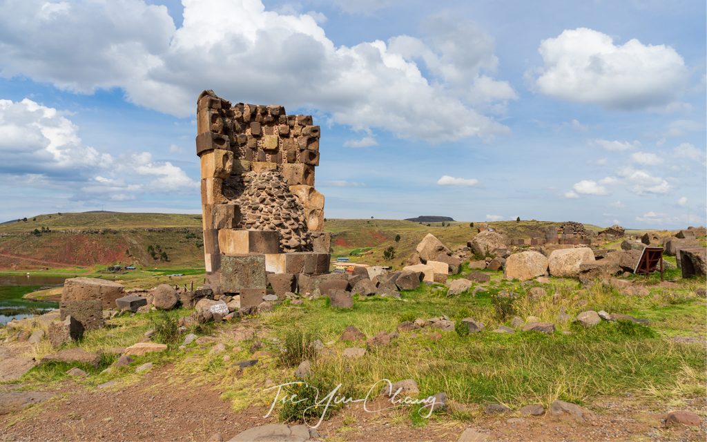
Sillustani, located on the shores of Lake Umayo near Puno is one of the main archaeological attractions in the Lake Titicaca area. It is a pre-Incan site that consists of a group of huge cylindrical tombs constructed by the Qulla people to bury their nobility
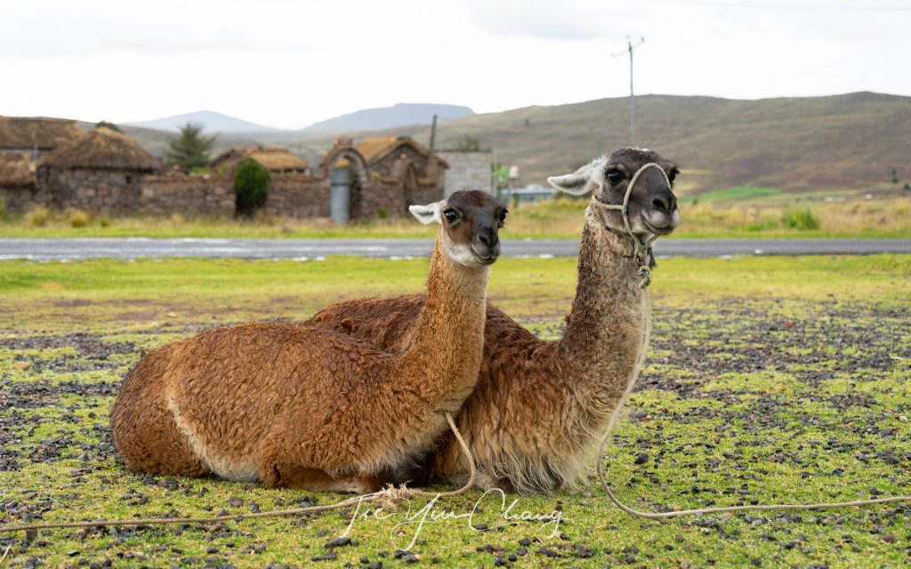
Getting up close and personal with the locals – llamas on a traditional Peruvian farm
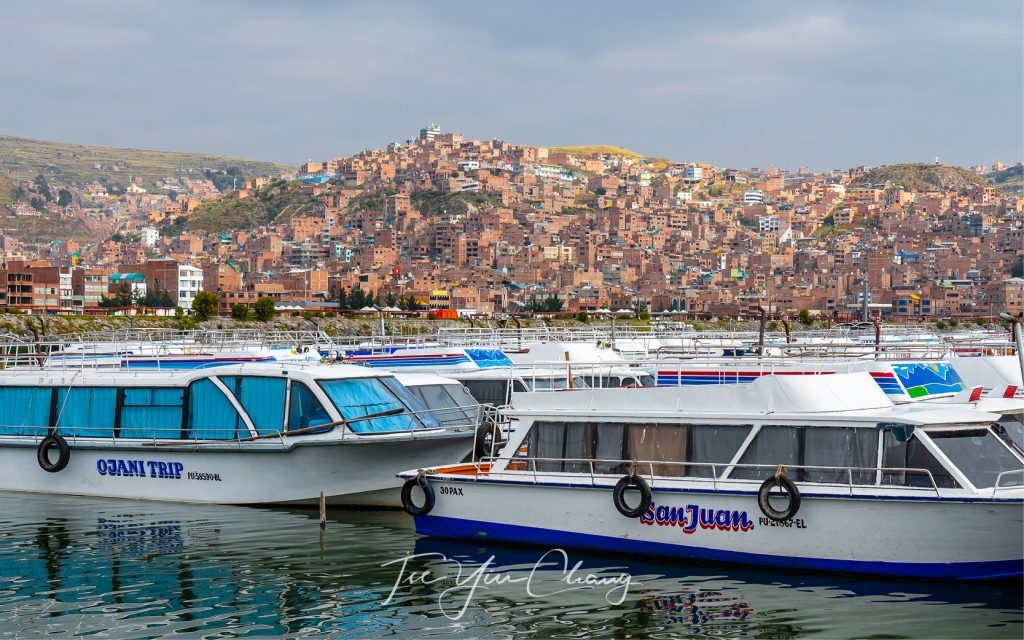
The town of Puno is located at the edge of Lake Titicaca
Home to many unique indigenous plants, Taquile Island offers scenic hike on the rugged landscape and views of Lake Titicaca
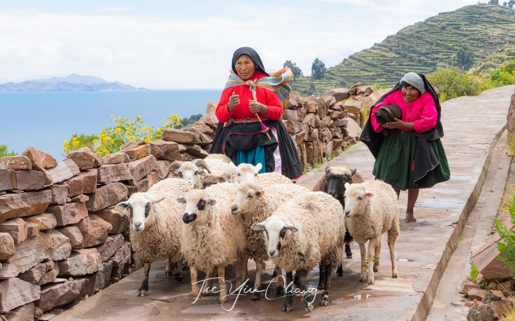
Local sheep farmer, Taquile Island, Lake Titicaca
One of the many Uros floating islands on Lake Titicaca
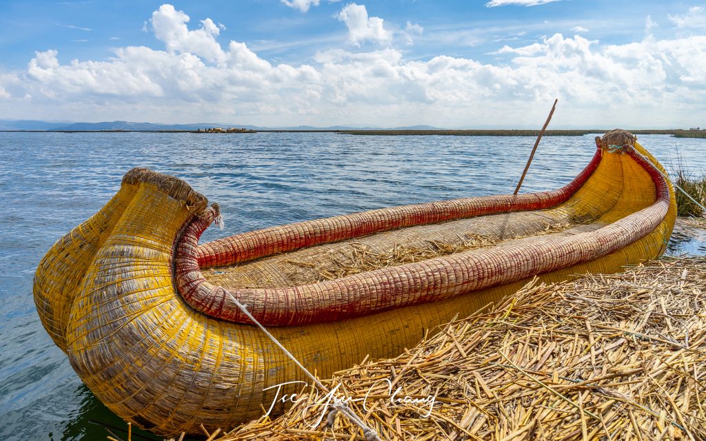
Totora reed boats built by the Uros people are among the oldest known types of boats
Self-sufficient Uros people weave and sell their handicrafts
The part of the country which the train travels through is known as the altiplano
The memorable once-in-a-lifetime adventure travels between Puno and Cusco lasts approximately 10 hours
Dramatic white peaks
The wooden paneling in the interior of the train makes it feel like something from the golden age of rail

Filed Under: Blog, Photography, Portfolio, Travel Tagged With: altitude, cusco, inca, lake titicaca, peru, puno, rail, south america, travel

Norway in a Nutshell – Part 2: Myrdal, Flam and Fjord Cruise

11 December 2017 by tadgraphics

Myrdal Station
Colourful cabins and a hotel in the snowy hillside of Myrdal

Think about Norway, and most likely it’s the country’s beautiful mountains and fjords that comes to mind. Most people visit Norway to see the fairy-tale landscapes, and yes, we were no different to other tourists in that respect.

We had just spent an enjoyable couple of days in Oslo, soaking up the atmosphere of Norway’s fascinating capital. Without question, seeing the history of the country embodied in the old buildings, and getting the full New Year’s experience surrounded by people in such a special place was truly unforgettable. But now we were eager to see and explore some of Norway’s famous natural attractions.

The Bergensbanen is not only the highest train line in Europe, and is said to be one of the best rail routes in the world
Myrdal Station. The Bergensbanen is not only the highest train line in Europe, and is said to be one of the best rail routes in the world

The day of adventure started out with a train delay. Not ideal, because when visiting at this time of year, one has to make the most of the daylight hours. But we didn’t let that dampen our spirits. Albeit an hour late, we eventually boarded the Bergensbanen train and by 9.30 am we were on our way.

The Bergensbanen serves an important practical purpose – linking Oslo to the country’s second city of Bergen over the mountainous rooftops of Norway. It is also a very popular method of transport amongst tourists, because the train journey provides an ideal opportunity to enjoy some of the country’s spectacular natural features. While both ends of the line sit at sea level, to get between them the train must ascend more than 1,000 meters over the mountains.

Flåm Railway
Voted one of the world’s most beautiful train journeys, the Flåm Railway offers panoramic views of some of the wildest and most magnificent nature in the Norwegian fjord landscape

The Bergensbanen is not only the highest train line in Europe, and is said to be one of the best rail routes in the world. As we climbed along Europe’s highest mountain plateaus, the views became more and more beautiful, with the very best section nestled between the villages of Gol and Geilo. Winter felt like the best time to experience Norway, as the blanket of snow made it feel more authentically Norwegian, and added a layer of photogenic charm.

Norway's fairy-tale landscapes never ceased to amaze
Norway’s fairy-tale landscapes never ceased to amaze

Close to the route’s highest point, another smaller train line cuts off, which allows you to enjoy even more of the otherworldly landscapes. We took a detour from Myrdal to Flåm on board Flåmsbana (also known as Flåm Railway). While waiting for our train to Flåm, we managed to explore the snowy hillside on foot. Fortunately, we were wearing appropriate footwear!

Voted one of the world’s most beautiful train journeys, the Flåm Railway offers panoramic views of some of the wildest and most magnificent nature in the Norwegian fjord landscape. The 20.2 km railway, which took 20 years to complete, is one of the steepest train lines in the world. The journey passes through 20 tunnels, of which 18 were built by hand. While the original intent of the train is to help locals get around, the spectacular scenery meant that it is now largely used by tourists like us.

Kjosfossen Waterfall
Kjosfossen Waterfall is one of the most visited tourist attractions in Norway

Unfortunately, it was here that the earlier delay leaving Oslo cost us. When you are this far north the sun sets early in mid-winter, and by the time we boarded the Flåm Railway at 3 pm the sun had already set. It meant we didn’t get the clear views we hoped for as there was very little light outside.

The train made a short stop at Kjosfossen Waterfall, which was a highlight of the train ride. With a fall of 225 metres, it is one of the most visited tourist attractions in Norway. If you visit, you’ll notice a small power station, built at the side of the waterfall, which used to power the Flåm Railway.

Impressive view of Aurlandsfjord in Flåm

Despite the fading light issues, the train journey – which took us on a 900 metres descent along the valley bottom – was a delightful experience from beginning to end. From inside the train we had a first hand view of rivers cut through deep ravines, waterfalls cascading down the side of steep, snow-capped mountains, and mountain farms clinging dizzily to sheer slopes. It was all quite a sight to behold.

Flåm was by far one of the most magical places we visited during our Norway trip. Flåm means ‘little place between steep mountains’ and it is certainly an accurate name. Running parallel to the train track is a small river which turns into the Aurlandsfjord when it reaches the village. After spending a night at the Flamsbrygga Hotel, the fjord was the next attraction to tick off our list.

Flåm waterfront
Flåm waterfront

We spent the morning walking around the valley, including a short return stroll to the next settlement – Lunden. In the afternoon we boarded our boat, and set off on a cruise of the fjords. Rather than retrace our steps from Myrdal to Bergen on the Bergansbanen train, we took the scenic route and headed into the network of fjords and then to Gudvangen where we would be taken by bus to meet the train.

Rustic and cosy Flåmstova Restaurant in Flamsbrygga Hotel

Norway is of course famous for its fjords; water filled valleys, that snake like fingers through the mountains and out to sea. As they do this, they connect up to each other and create a complicated network. The Aurlandsfjord runs north from Flåm to meet the Nærøyfjord – a world heritage listed site and the narrowest fjord in Europe. Being enclosed so tightly by the cliff-like walls makes them even more imposing and dramatic. And to make it that bit more picturesque, the sides of the fjord were punctuated by mighty waterfalls and small farms clinging on to the cliffs at impossible angles.

Perfect reflection of the fjord in Flåm

The Nærøyfjord is itself one arm of the Sognefjord, and we reached this wider waterway in good time. We met our bus at Gudvangen, and were taken to the town of Voss to re-join the Bergen train line. It was snowing by this point, which meant our bus couldn’t take the Stalheimskleiva – Northern Europe’s steepest road. We were however still treated to some incredible landscapes on our bus journey to the train, which included negotiating a thrilling succession of thirteen hairpin bends! Something made even more hair-raising in such a big bus.

At Voss we boarded the train, and relaxed for the last part of the journey to Bergen. It gave us an opportunity to reminisce over our adventures to date, and contemplate what was to come next.

Snowing in Voss as we boarded the train to Bergen

Prints from my Norway photo collection are available in a variety of different sizes and framing options. Please get in touch to find out more.

See also:
  • Norway in a Nutshell – Part 1: Oslo

Scenic Bergensbanen, the Bergen Railway

The Flåm Railway and Flåm

Myrdal Station
Myrdal Station is the upper point of the Flåm railway and only accessible by train
Snowy hillside of Myrdal
The train stops along the Flåm Railway
Flåm Railway
The Flåm Railway journey passes through 20 tunnels, of which 18 were built by hand
The Flåm Railway is one of the steepest trainlines in the world
It was a snowy and icy morning in Lunden
View of Aurlandsfjord in Flåm
Flåm village
Flåm village
Approaching Nærøyfjord – a world heritage listed site and the narrowest fjord in Europe
The sides of the fjord were punctuated by mighty waterfalls clinging on to the cliffs at impossible angles
Aurlandsfjord
Aurlandsfjord

Filed Under: Blog, Photography, Portfolio, Travel Tagged With: bergen, cruise, fjord, flam, flamsbana, myrdal, nordic, norway, rail, scandinavia, travel

© Copyright 2005-26. All rights reserved. t ad studio | tad graphics. Web and graphic design Perth. Admin