• Skip to primary navigation
  • Skip to main content
TAD Graphics logo

t ad studio | tad graphics

A vibrant, multi-disciplinary advertising, communications, creative and digital agency

  • About us
  • What we do
    • Creative and graphic design
    • Copywriting
    • Marketing and advertising
    • Promotional photography
    • Web design and digital media
  • Portfolio
  • Blog
  • Contact us
  • Shop prints

UNESCO

Machu Picchu – a 15th century Inca citadel

4 January 2020 by tadgraphics

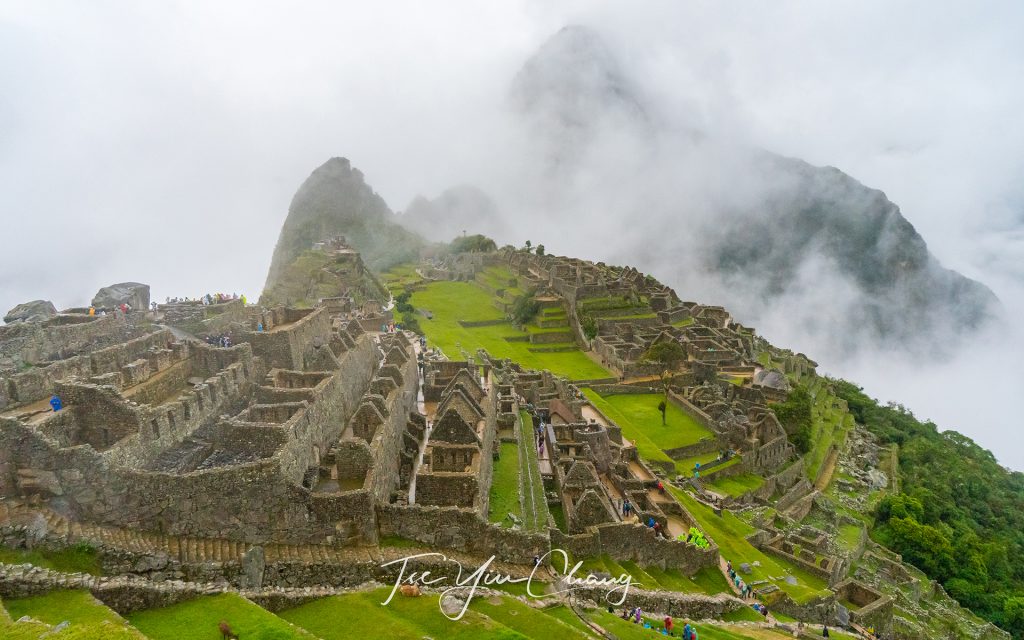
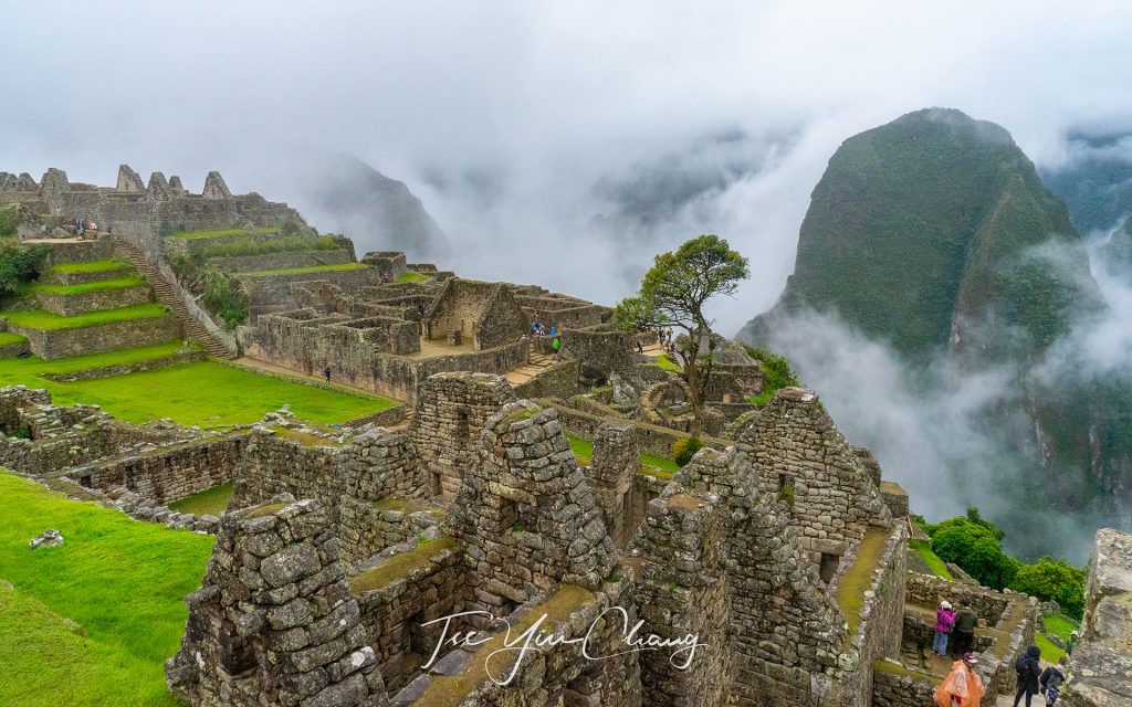
The famous shot of Machu Picchu, view of the main square from the city gate. Huayna Picchu is hidden behind the cloud
The iconic shot of Machu Picchu, view of the main square from the city gate. Huayna Picchu is hidden behind the cloud

Pretty much everyone who visits Peru goes to Machu Picchu at some point. For many people it is the main reason for visiting the country. It is without doubt one of the most recognisable places in the world, and one of the most photographed. It is considered to be one of the new Seven Wonders of the World, as it is one of the most significant pieces of human patrimony.
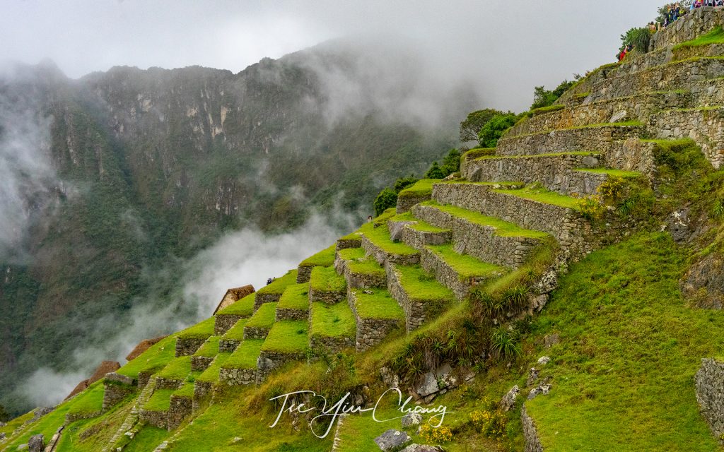
Agricultural terraces, you can more clearly how the terraces were built, amazingly, the Inca managed to carve out their stepped terrace farms even on these near vertical slopes

We too were making our way there, but we had taken the scenic route. We crossed the Altiplano by train and visited several other Inca sites; stopped at Cusco, Ollantaytambo and Pisac among others, and each had been breath-taking and deserving of some of Machu Picchu’s fame. Like everyone else however, we were looking forward to seeing the big one. There is a reason everybody wants to go to Machu Picchu.
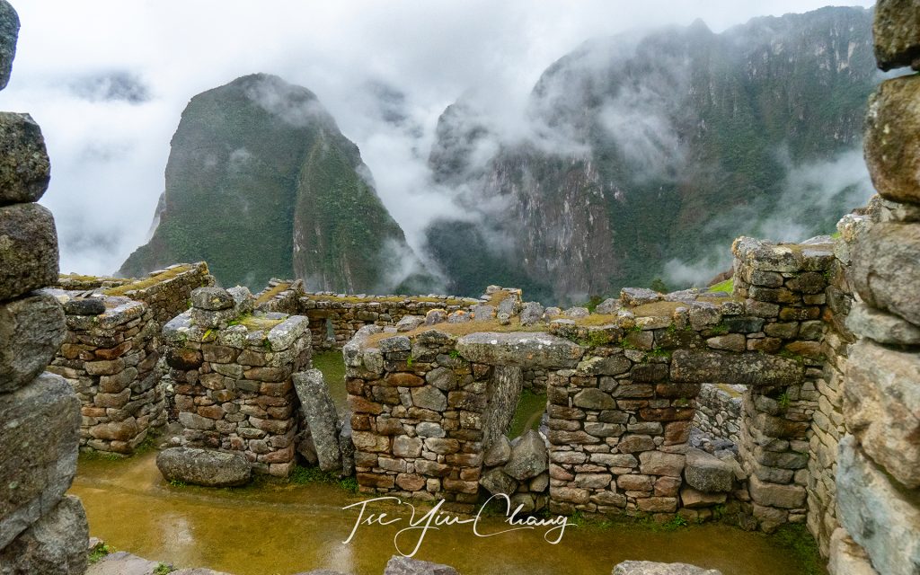
Entrance to the main square

The nearest settlement is Aguas Calientes, and this is where we stayed overnight. After breakfast, we walked over to the tourist information centre where we met with our guide and caught the bus. Guides are mandatory when visiting Machu Picchu, a requirement set by the government. As well as providing visitors with some context, they also help ensure that the huge numbers of tourists are managed (thus protecting the site), and also provides employment for Peruvians. We had got a sense of how huge those numbers were while in Aguas Calientes, but it was rammed home as we waited for the bus. The queue was very, very long.
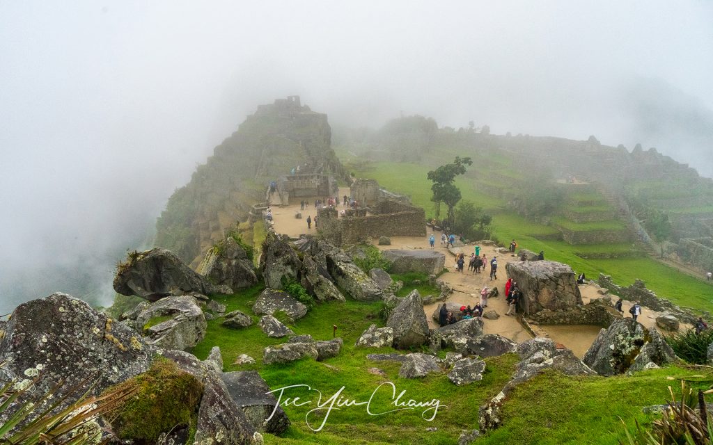
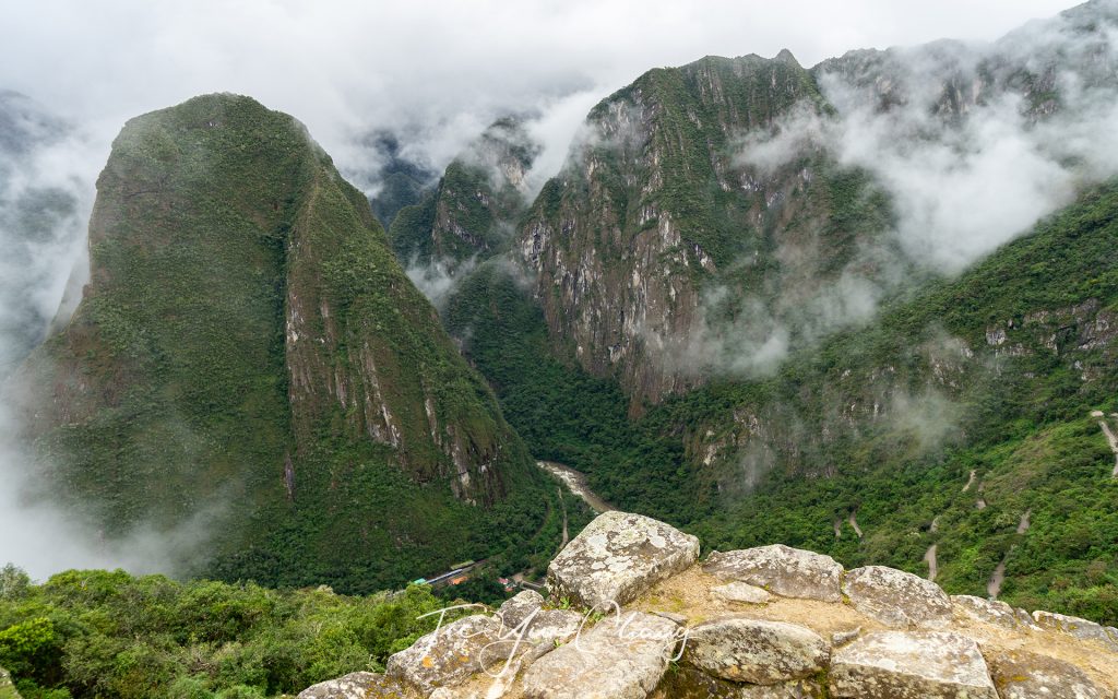
On a clear day you can see a beautiful view of the valley below, this is an abandoned quarry

Machu Picchu is the historic site which gets by far the most attention in Peru. However, for the Inca who built it, this was far from their most important settlement. In fact, it was a relative backwater. The remote location, on the top of a mountain hidden up an inaccessible valley, is what makes it so spectacular, but it also made it a poor place to build a thriving city. Instead (clearly being a man who appreciated natural beauty), the Inca Emperor Pachacuti decided to build a personal estate to give himself a place to retreat from the pressures of ruling. At its height, Machu Picchu had a population of around 750 people, but this probably would have increased when Pachacuti visited.
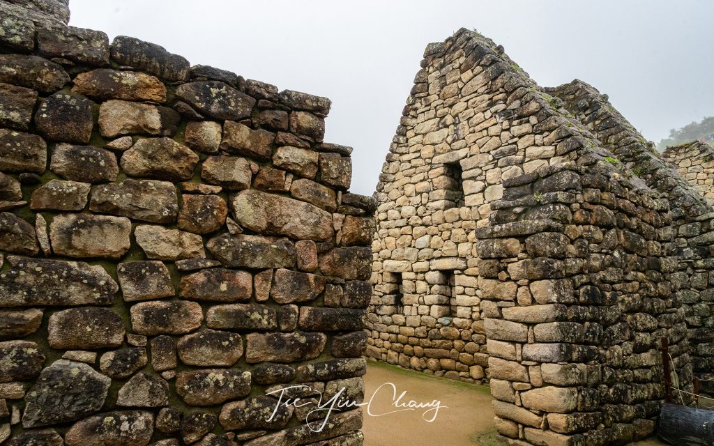
The Palace of the Princess or Ñusta Palace

The weather on the morning we visited was overcast, thus making it the perfect temperature to go climbing up and down steep hills. As we climbed up to the site however, the clouds started moving in and when we reached the top, the rain started. As we wandered around the views were obscured by mist and being a photographer, I knew I was being denied some great shots. Despite this, we weren’t too disappointed because as the mist swirled around the jagged ruined walls, it added to the ethereal atmosphere of the place.
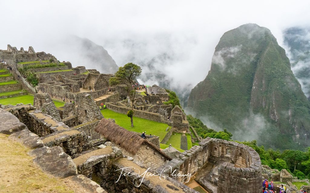
The semi-circular structure is the Temple of the Sun
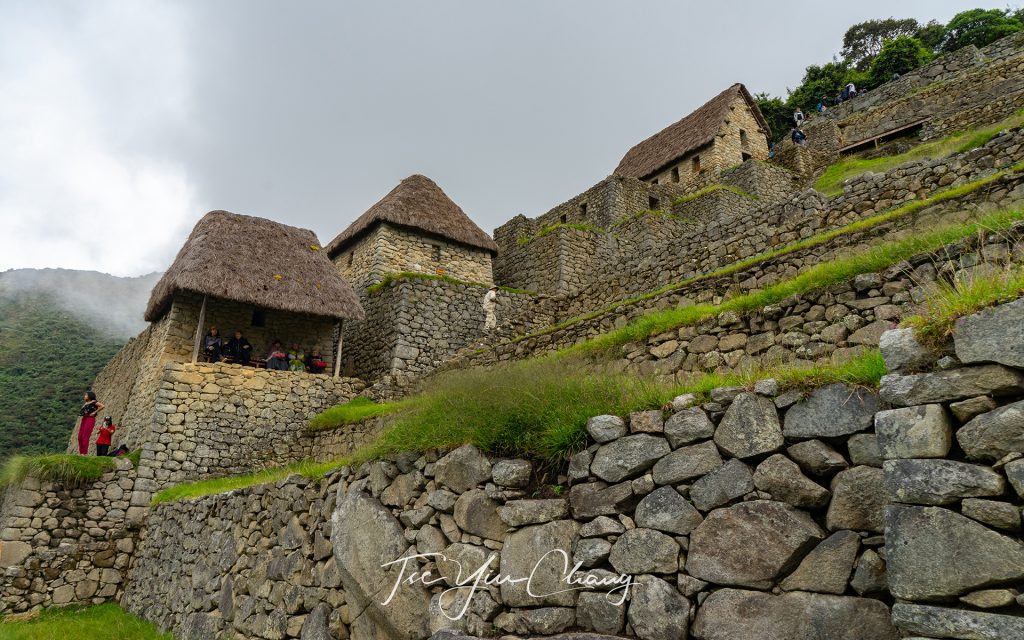
The semi-circular structure is the Temple of the Sun, Royal Residence behind the thatched roof. You can see the eastern urban sector in the background

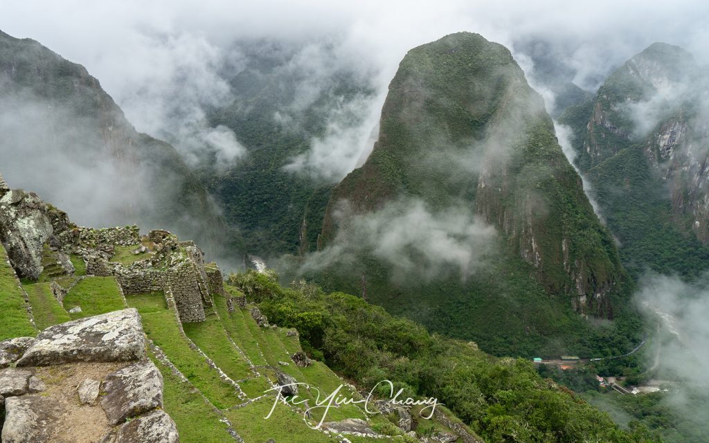
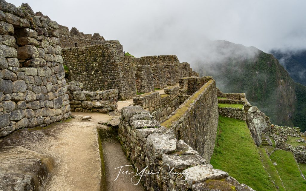
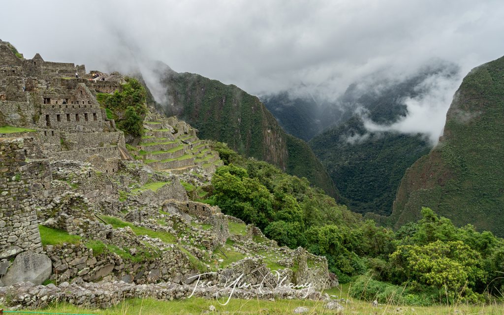
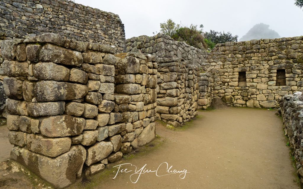
Our guide led us along the increasingly muddy paths which loop around the ruins. She showed us the settlement’s main square, the circular tower (most likely used as an observatory), and the sacred solar clock. We were shown the palace where the emperor would have stayed, the temple of the three windows and then the cemeteries. The upper part of the city is home to the palace and the sacred temples. Just below are the houses that the bulk of the population would have lived in as well as the grain warehouses. Amazingly, the Inca managed to carve out their stepped terrace farms even on these near vertical slopes. As you look down at the valley below, you can still see the stone embankments they built to give themselves scraps of flat land to grow crops on.
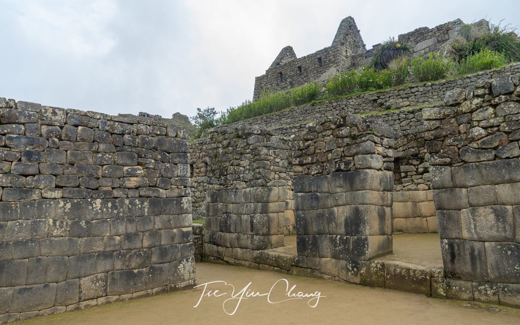
Houses of factories
Houses of factories

Despite the weather and the crowd, the majesty of Machu Picchu is undeniable, and it was clear  that its UNESCO world heritage site status is more than justified. It is a magical, mysterious place that feels like something from a fantasy story. The American explorer,  Hiram Bingham, must have found it even more so when he rediscovered it in 1911. He had the place all to himself (with the exception of his indigenous guide, of course). In fact he would have been one of just a handful of visitors since the site was abandoned by the Inca during the Spanish conquest hundreds of years before.
Bingham was a real life Indiana Jones, whose adventures are as fantastical as Machu Picchu itself. Coming from a family of missionaries in Hawaii, he set of for Chile in 1908 for a conference and instead of returning home, decided to wander through the jungles of Peru looking for lost Inca cities. Machu Picchu was not the first that he discovered, he was also the first to document the existence of Vilcabamba, also known as the Lost City of Inca. It was the city where the last Inca emperors hid and mounted a guerrilla campaign against the Spanish. He had heard rumours of another forgotten city, high up in the mountains, and eventually persuaded a villager named Melchor Arteaga from the valley below to take him there. Although others probably visited Machu Picchu before him, he was the first to document it and bring it to the world’s attention.
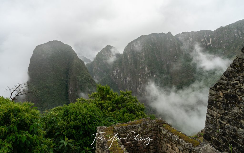
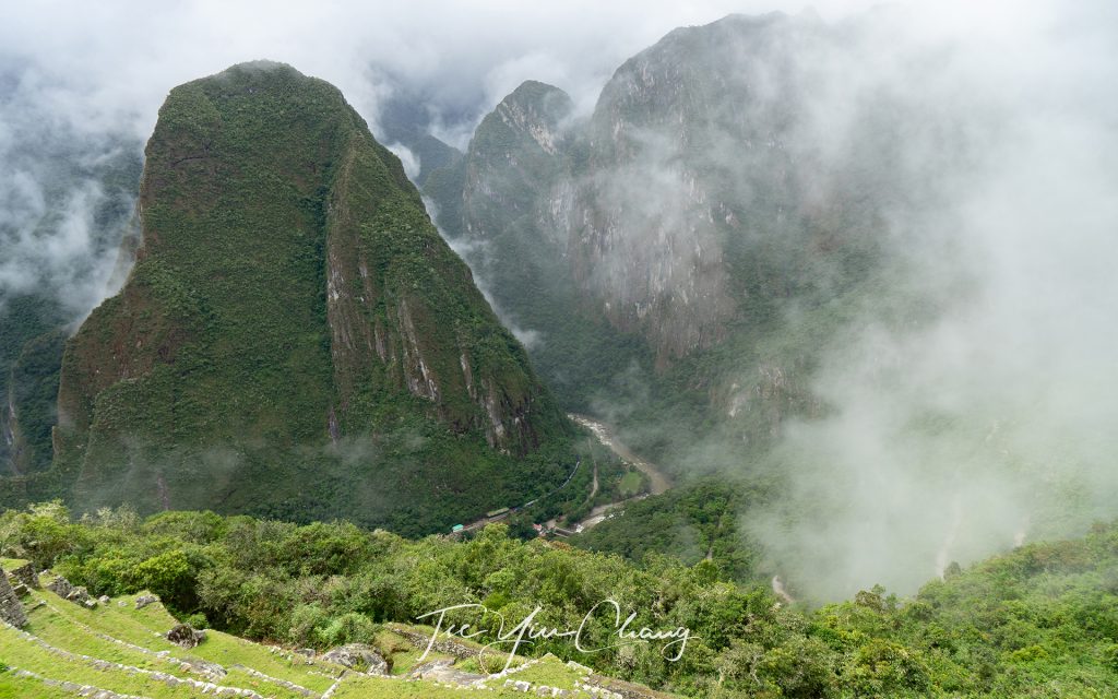
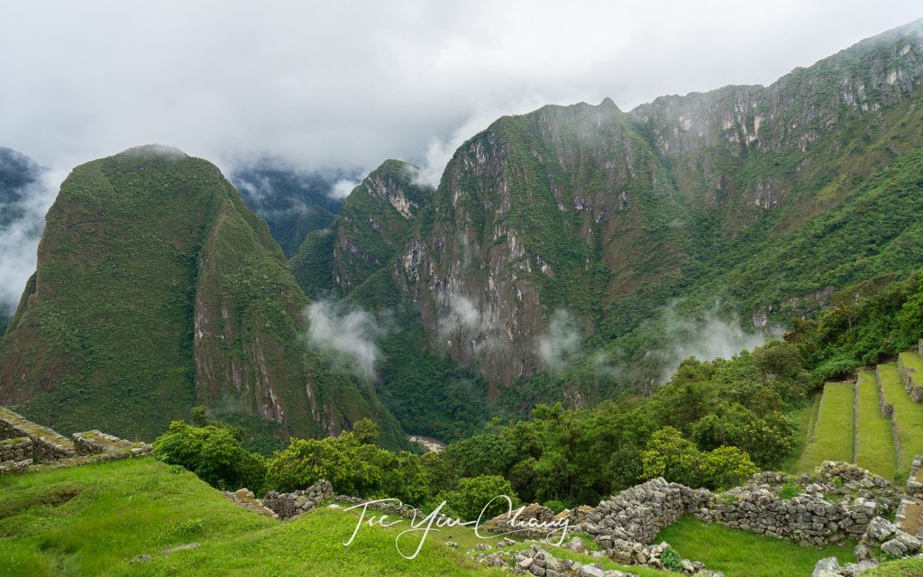
Mysterious yet beautiful view looking down to the valley

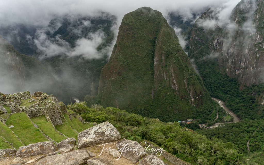
Hiram Bingham took a photo of the site from a viewpoint looking down over it. This is the same famous shot which hundreds of people now take every day. It shows the ruins, the sheer cliff faces on either side, and the equally sheer peak towering behind. This is Huayna Picchu, and if you really want the full experience, it can be climbed as well. To do so, however, you need to book well in advance – its narrow paths only allow a certain number of people at a time, and so access is controlled by the Peruvian Government. If you want to climb it, you have to book at least three months ahead.
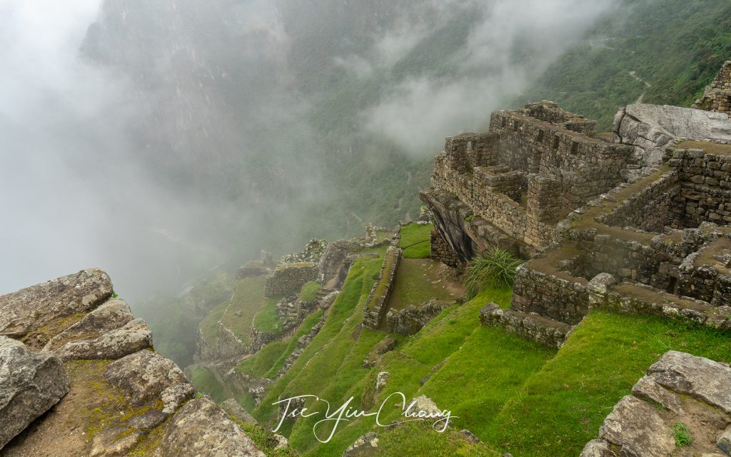
Steep terraces, looking down from Intihuatana

Another measure imposed to limit the impact of the huge number of visitors Machu Picchu generates, is to limit the time you can spend there to a maximum of four hours. If you really wanted to, you could spend a whole day up there taking it all in, but four hours is long enough to see everything, so we didn’t feel deprived. At around midday we headed back down to Aguas Calientes and enjoyed some lunch. Then we wandered around the souvenir markets while we waited for the late afternoon train back to Ollantaytambo. There, we met our driver and headed back to Cusco. While the weather had been against us, that couldn’t take away our delight at having visited such an awe inspiring place.
See also:

  • A journey through the picturesque Andes by rail
  • Exploring the capital of the Inca Empire – Cusco
  • Sacred Valley – the gateway to Machu Picchu
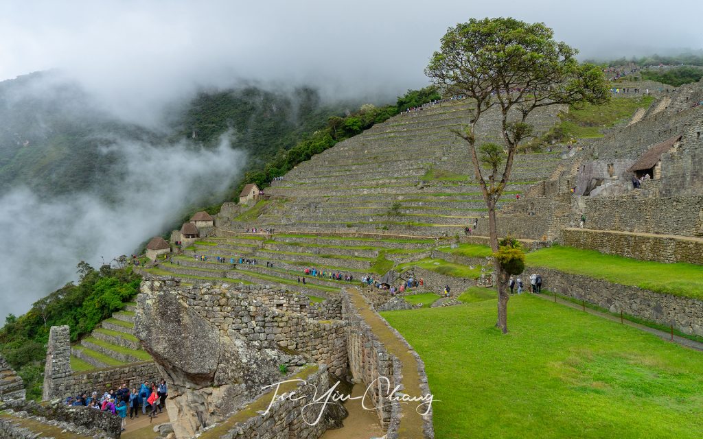
Agricultural terraces
Looking up to the Temple of Three Windows
Picturesque Huayna Picchu and the Urubamba Valley and river
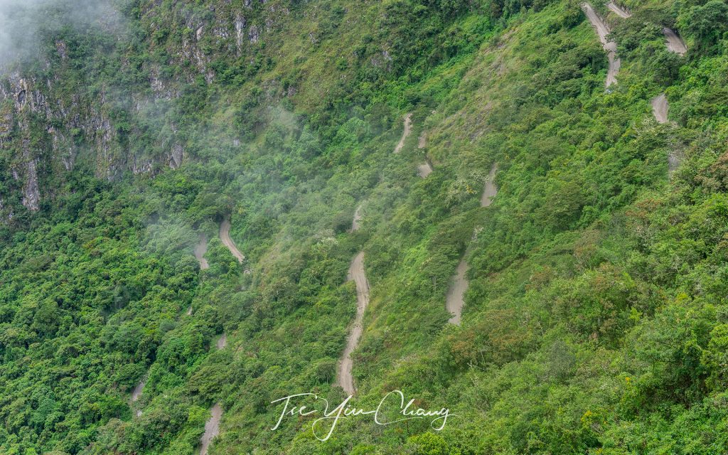
This is the winding road we took from Auas Calientes going up to Machu Picchu
The main urban area consists of houses and factories
Huayna Picchu
Huayna Picchu
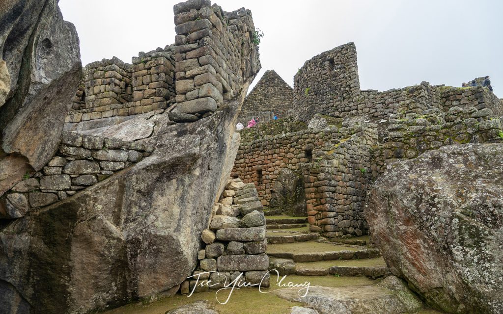
The Temple of Condor is a fine example of Inca stonemasonry, where they skillfully shaped it into the outspread wings of a condor in flight
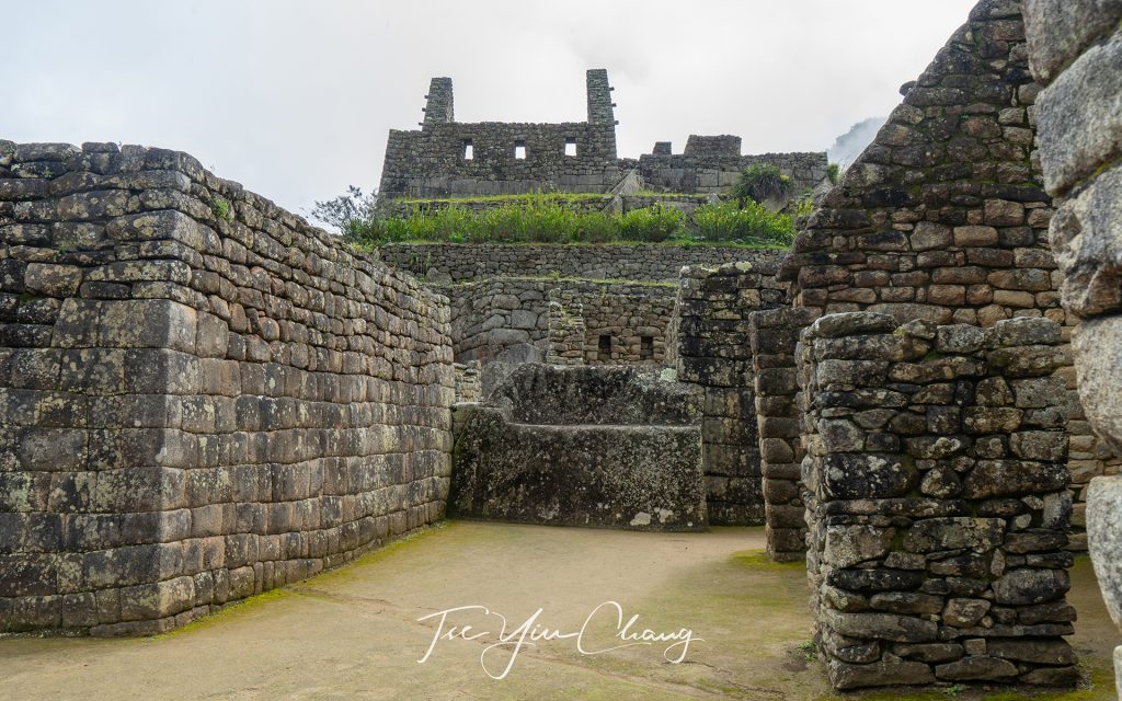
The prisoners area
The prisoners area
House of the Guardians
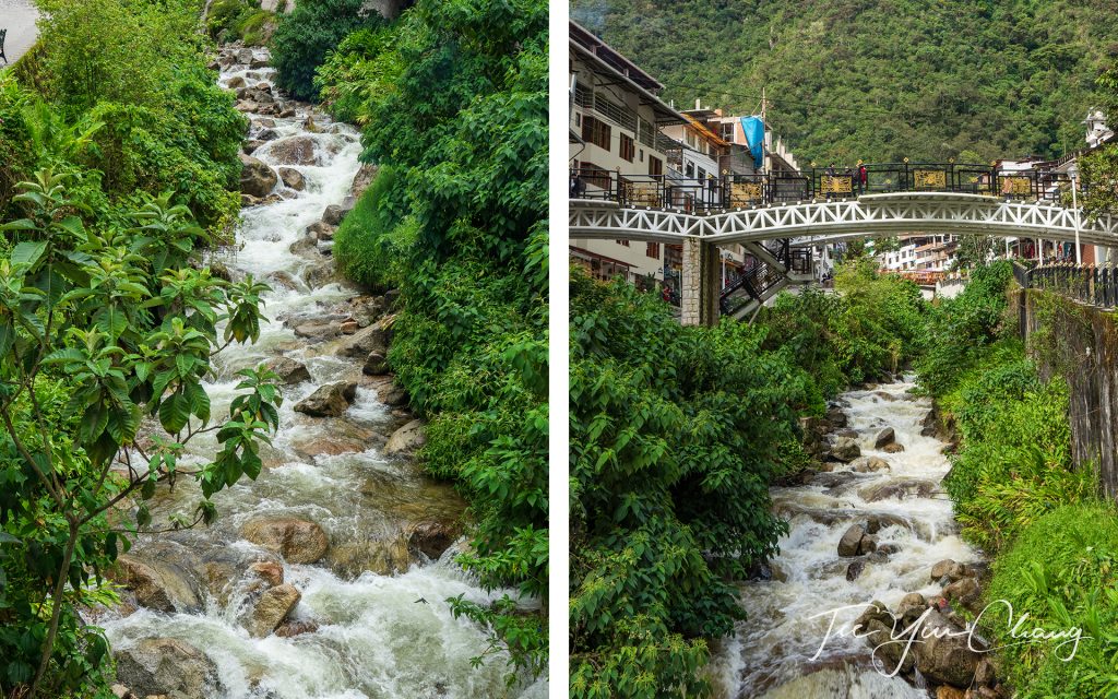
Aguas Calientes, which means hot waters in Spanish, is often referred to as Machu Picchu Town
Aguas Calientes is a town in the Urubamba River Valley

Filed Under: Blog, Photography, Portfolio, Travel Tagged With: altitude, inca, machu picchu, peru, sacred valley, south america, spring, UNESCO

Sacred Valley – the gateway to Machu Picchu
13 December 2019 by tadgraphics

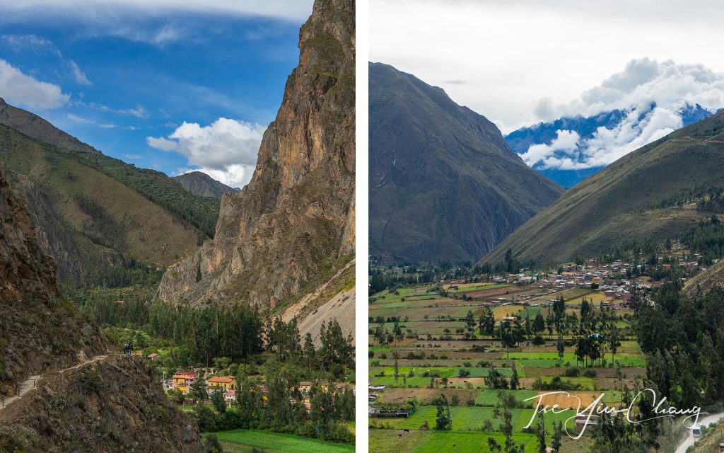
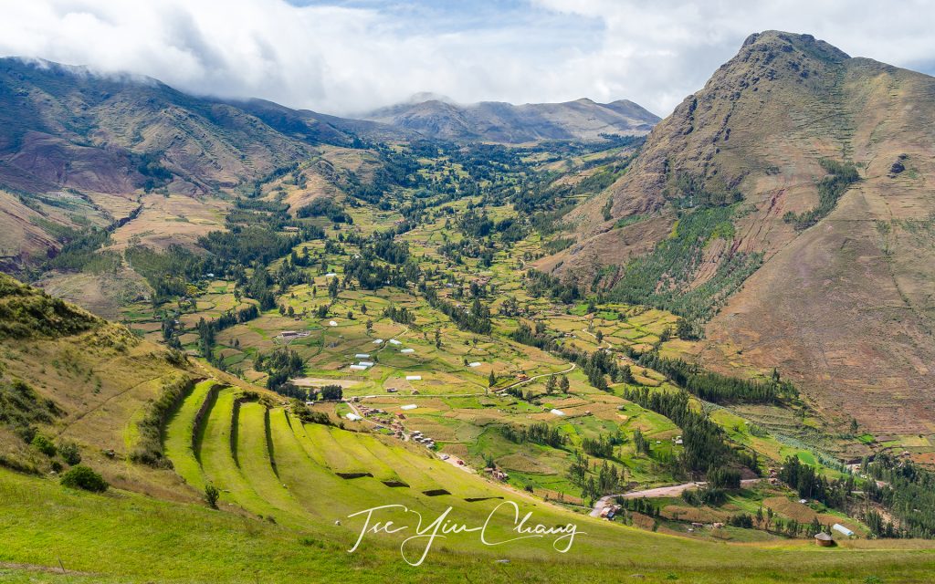
The Sacred Valley was one of Inca's most important places
The Sacred Valley was one of Inca’s most important places

Peru’s southern highland provinces are so packed with the ruins of Inca civilisation that sometimes it feels you can’t go anywhere without stumbling across one. It is only by visiting them and seeing for yourself the sheer number of constructions and the skill that their builders possessed, that you can appreciate the advancement of the Inca civilisation. At its height, it covered as many territories as the Roman Empire, and despite their eventual defeat to the Spanish, you can’t help but feel that in terms of power and sophistication, they were close rivals to the Europeans of the time.

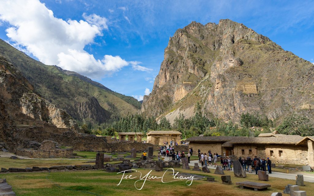
It is only by visiting and seeing for yourself the sheer number of constructions and the skill that their builders possessed, that you can appreciate the advancement of the Inca civilisation. This is Ollantaytambo Ruins

We had just taken in Cusco, their empire’s capital, and were planning to make our way to Machu Picchu. It was tempting to head straight there, but between these two sites is a place nobody should miss. The Sacred Valley of Urubamba was one of the Inca’s most important places and, as such, it has a particularly high number of impressive ruins. We decided to take a day taking in the sites of the valley.

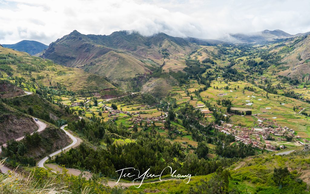
Pisac is located at a strategic position at the head of the Sacred Valley

This valley was important to the Incas, not just because of its proximity to their capital, but also due to the relatively lower altitude. In a place as high up as this part of Peru, this is a rarity. Because of this, the valley could be farmed more intensively than elsewhere, and corn, an uncommon and important status food for the Inca elites, could thrive. Its fertility was aided by the Urubamba River which flows along the valley floor. As the valley grew in importance, several towns sprung up and the valley became one of the favoured retreats for the elites and the emperor himself. The rich and powerful started to build large estates for themselves, so that they could escape from the city to relax from time-to-time.

View of Pisac town from the archaeological park

Our first stop was Pisac, located at a strategic position at the head of the Sacred Valley. The small town of Pisac is still inhabited by the Quechua speaking descendants of the Inca. During the height of their ancestor’s empire however, it was a thriving town, so large that its remains are spread out across four separate complexes.

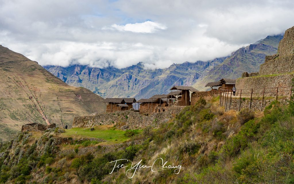
Kinchuraqay, perched precariously on the side of the hill, were grain stores where precious corn was kept

Pisac’s main purpose was to guard the southern end of the valley, protecting both its precious agricultural land, and the heartland around Cusco from invaders. It is theorised that the main threat were the Asháninka people who lived down in the jungle on the eastern foothills of the Andes. These people resisted Inca conquest fiercely and may have launched raids up into the mountains.

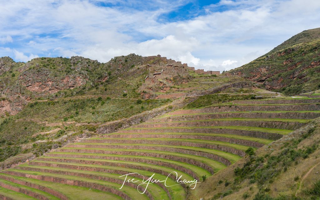
The Inca carved out dramatic terraces from the hillside to be used for agriculture, you can see Intihuatana sun temple at a distance

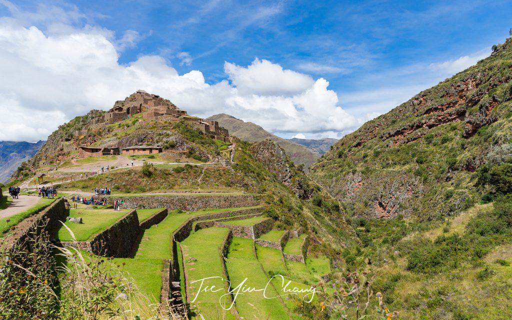
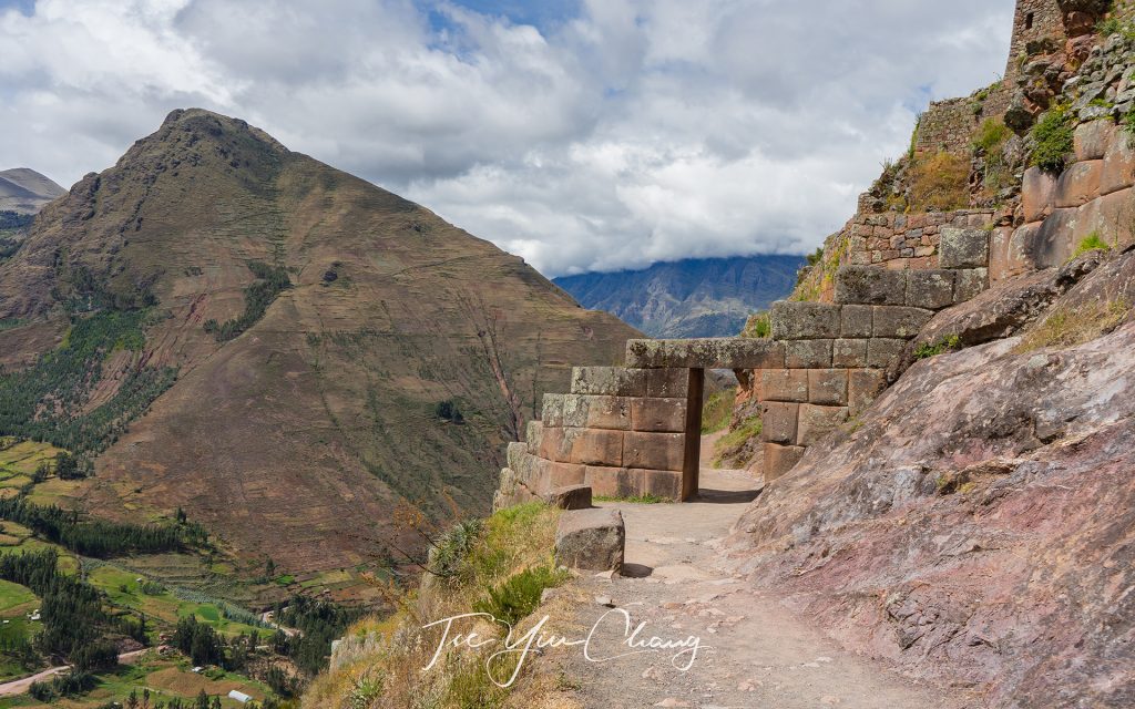
Pisac’s main attractions can be found up in the hills overlooking the village from the north. The first site we visited was Intihuatana – the sun temple. Inti was the favourite god of the Inca and he was associated with the sun. Here the name refers to the temple as a whole, but there are many Intihuatanas in Peru, and usually they take the form of a sacred stone which, when combined with the light of the sun, functioned as a type of clock or calendar. This one aligns with the sun during the June solstice, and within the temple there, is also an altar and a sacred spring. The temple is another fine example of the famous Inca stonework on display. Its location high up on the ridge gives it commanding views of the valley below.

Agriculture terraces and Intihuatana - the sun temple. Pisac is one of Peru's biggest archeological site
Agriculture terraces and Intihuatana – the sun temple. Pisac is one of Peru’s biggest archeological site

A little further down the slope is Q’allaquasa. This was the main Inca settlement where the majority of the ruins are of the houses which were occupied by the settlement’s ordinary inhabitants. Despite not being grand constructions, they are still impressive thanks to their position on the crown of a hill. To maximise the land available for agriculture, the Inca carved out dramatic terraces from the hillside, reminiscent of those in Eastern Asia. These still exist today, and some of the most impressive surrounding Q’allaquasa.

Inca doorway, marking the entrance to the sun temple

The final site we saw at Pisac was Kinchiraqay. Perched precariously on the side of the hill, these red stone buildings were the grain stores where precious corn was kept. Stacked one on top of the other, their charm is completed by the sloping thatched roofs, and as with almost every site in the Sacred Valley, the sweeping views their position gives.

Pisac is an important argricultural hub due to its climate and fertile soil

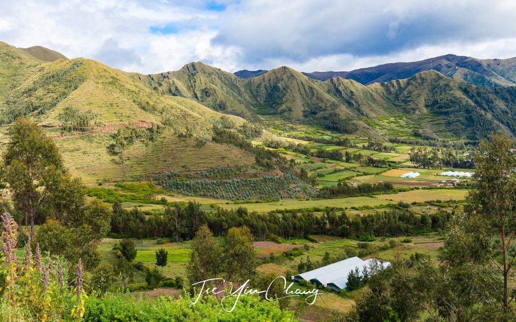
We moved on towards the town of Urubamba for lunch. Urubamba is one of the larger towns in the valley with a population of less than 3,000. It is situated at a spot where the valley opens up and provides enough space for a town, as well as for agriculture. On our way there we were treated to more of the valley’s striking scenery. Following the river along the valley floor, we were treated to an endless procession of pastoral fields bounded by towering peaks.

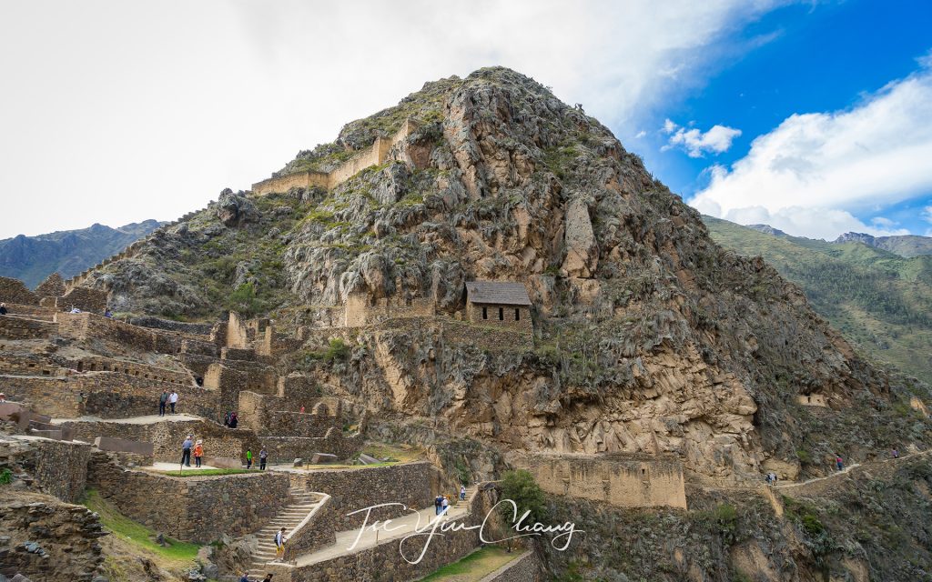
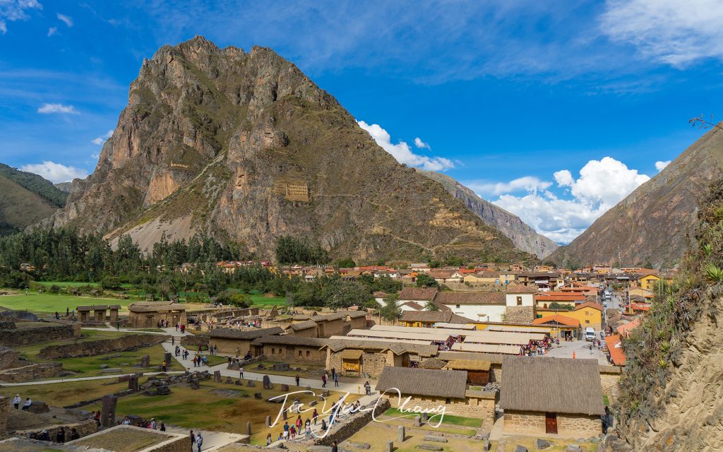
View of Ollantaytamboo old town from the ruins

After lunch we continued up the valley until we reached the region’s other major set of ruins. Just as Pisac guards the southern entrance to the valley, Ollantaytambo, also known as Ollanta by the locals, was designed to stop potential attacks from the north. The site was occupied long before the Inca arrived, however it was Pachacuti, considered as the most successful Inca emperor, who really transformed it into a significant place. He decided to set it aside as his personal estate after he had brought it into the empire.

The well-preserved Ollantaytamboo was once a stronghold of Inca resistance to Spanish colonisation

Here he constructed temples, defences and agricultural terraces, prompting the development of a town to house the workers of his estate. That town was largely demolished by the Spanish, but the rest of Pachacuti’s work has been preserved, albeit in ruined form. It is not hard to picture how grand this place must have been, despite its abandoned state.

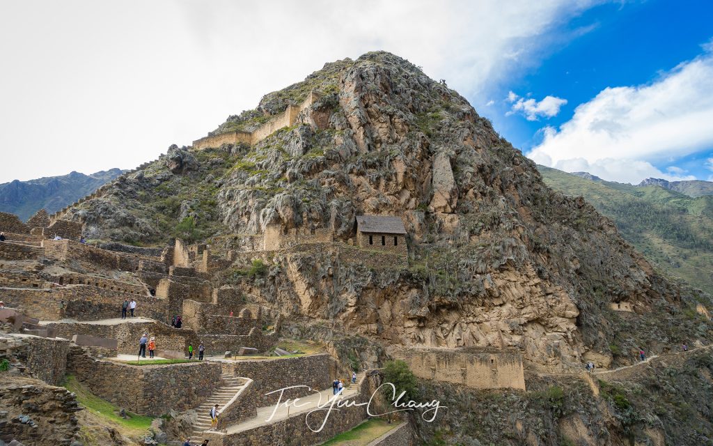
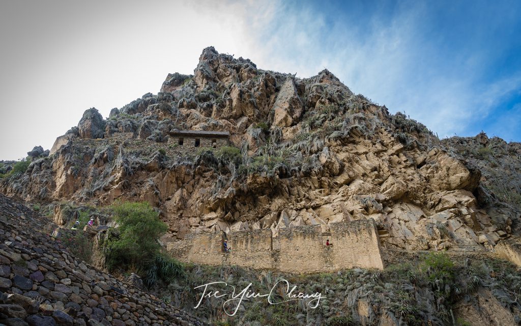
Ollantaytamboo looking across to Pinkuylluna mountain (right). If you look closer you will see the face of Wiracocha carved into the rocks. The Incas believed he was the creator of all. Next to it you can see the Pinkuylluna Incan storehouses, used to store agricultural crops to feed the town

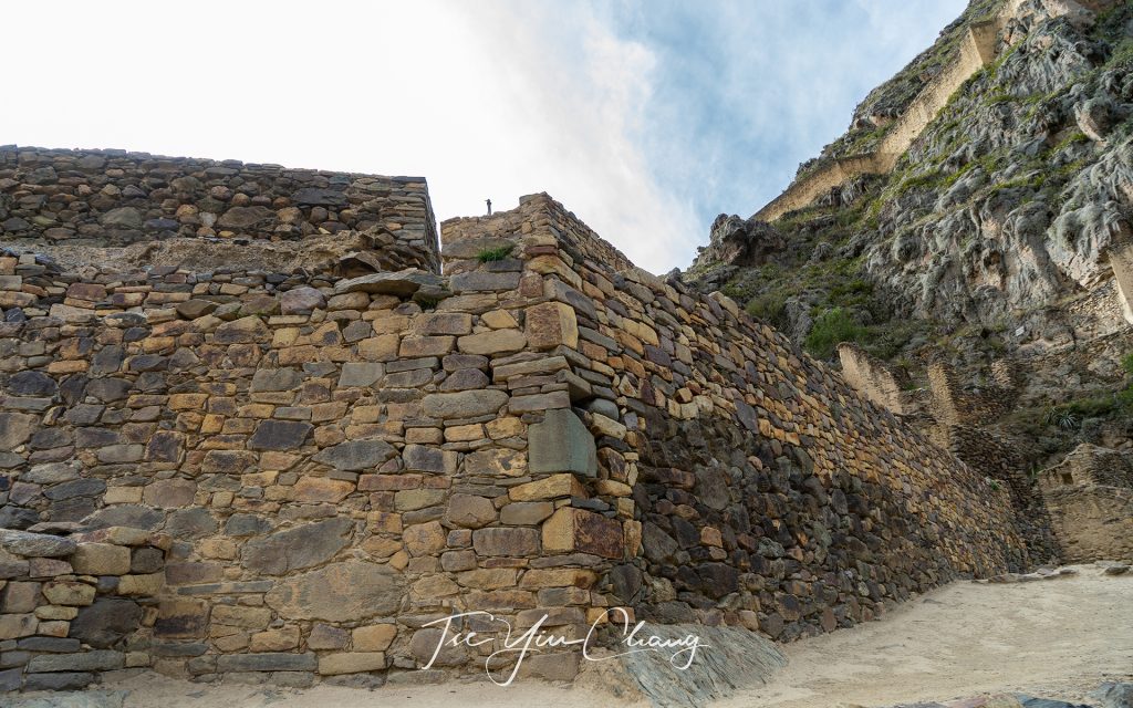
The famous and impressive Inca stonework is on display everywhere, and some buildings are almost complete, apart from a lack of roofs. Structures like the wall of the six monoliths, which forms part of the temple complex, demonstrate the highly developed engineering skills that the Inca possessed. Built from stones weighing more than fifty tonnes each, it’s a mystery how they managed to drag them up to this inaccessible spot. Archaeologists believe that the temple was never actually finished, and it is thought that Ollantaytambo was in the midst of a renovation when the Spanish turned up and terminated the construction.

Another example of the famous and impressive Inca stonework on display at Ollantaytamboo

Clearly its defences turned out to be of no use against the Europeans, but that doesn’t mean that they were not formidable. Smaller fortifications dot the hills around the main site (as do grain storehouses and quarries from which the building stone was obtained), and the Inca even diverted a stretch of the river so that it ran across the valley floor rather than along it. This gave invaders another obstacle to navigate. Like at Pisac, the hills leading up to the ruins have been extensively modified to create stepped terraces, and while those at Pisac are bigger, these are unquestionably neater.

The Incas possessed highly developed engineering skills

We were dropped at the Ollantaytambo Station in the afternoon and boarded the train to Aguas Calientes. If it wasn’t for the fact that this is the closest settlement to Machu Picchu, this town would be of little importance, hidden away between the towering mountains. Much of the town has been given over to the tourism industry, and its streets are packed with visitors.

Ollantaytamboo is the beginning of the Inca Trail to Machu Picchu

While the landscapes of the Sacred Valley are spectacular, Aguas Calientes is further up into the Andes, and, its setting is even more dramatic. The slopes are like walls, and the flat space beside the river where buildings can be constructed is limited. The result is a small, but bustling town, wedged improbably into every available bit of space. It was a pleasant enough place to spend the night, but like everyone else there we were more excited about what tomorrow had in store for us – the ruins of Machu Picchu.

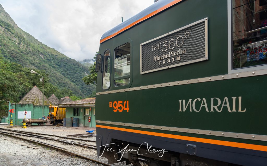
The scenic IncaRail 360o Machu Picchu Train has an observation outdoor carriage for travellers to admire the Andean landscape

See also:

  • A journey through the picturesque Andes by rail
  • Exploring the capital of the Inca Empire – Cusco
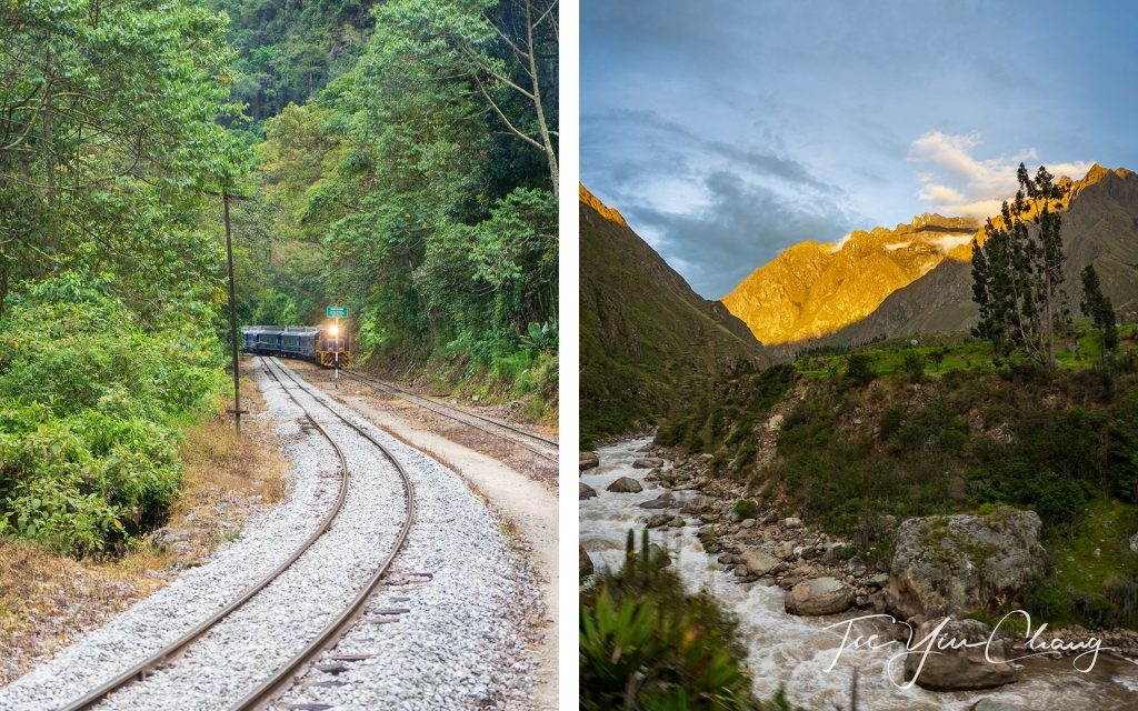
The IncaRail 360o Machu Picchu Train is one of the most panoramic journey in Latin America
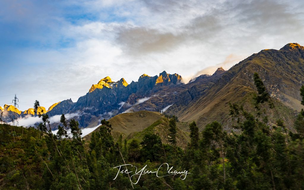
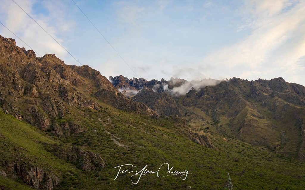
There were still snow on top of the mountains
Dramatic and spectacular Andean landscape along the train journey to Machu Picchu
Filed Under: Blog, Photography, Portfolio, Travel Tagged With: adventure, altitude, inca, machu picchu, ollantaytambo, peru, pisac, rail, sacred valley, south america, spring, UNESCO, urubamba
Castles of Copenhagen

18 October 2018 by tadgraphics

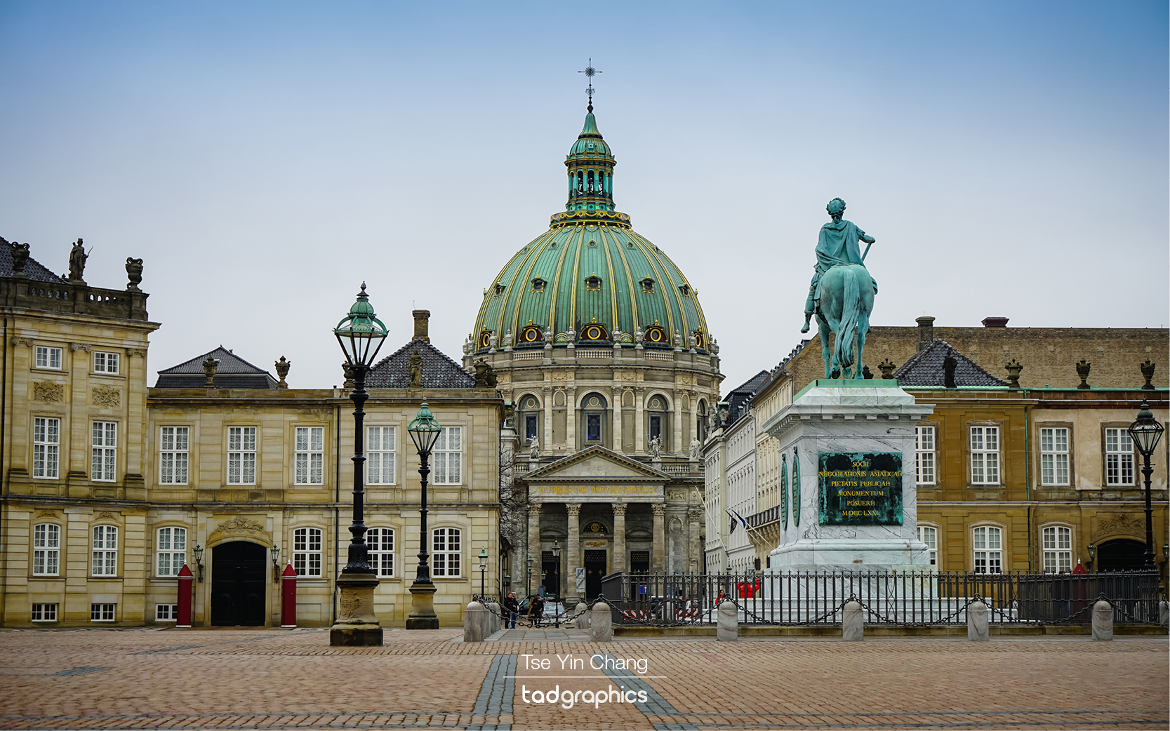
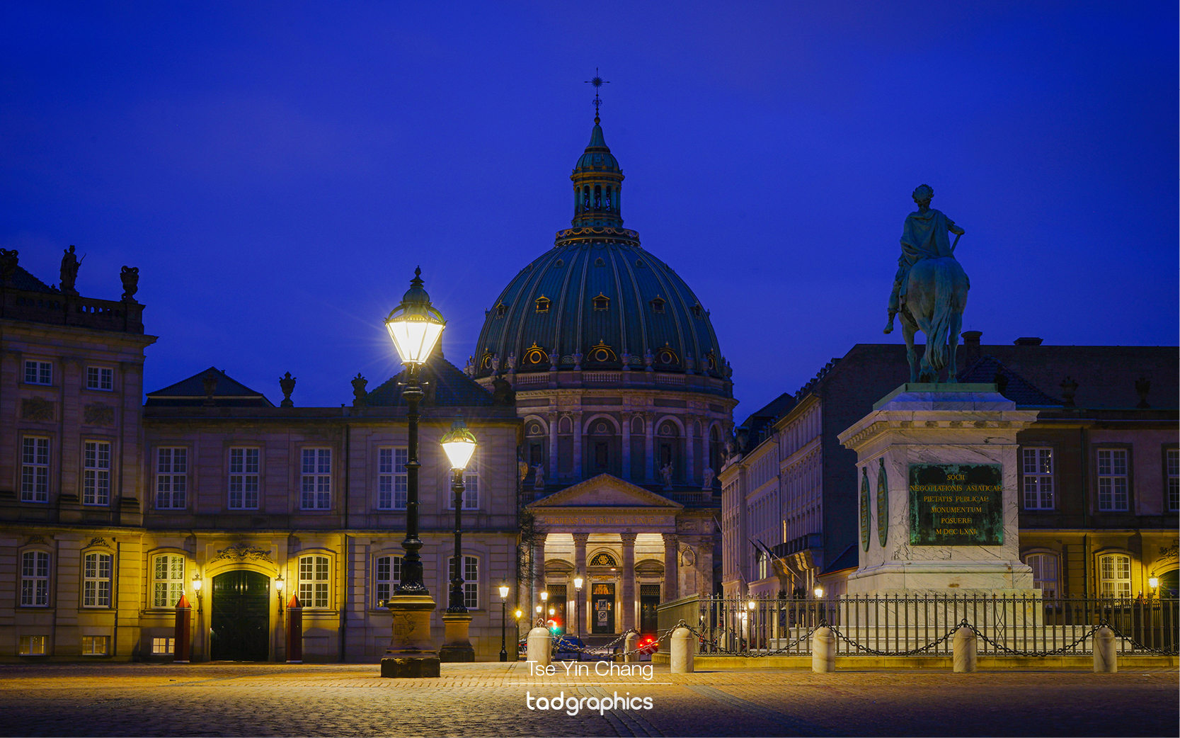
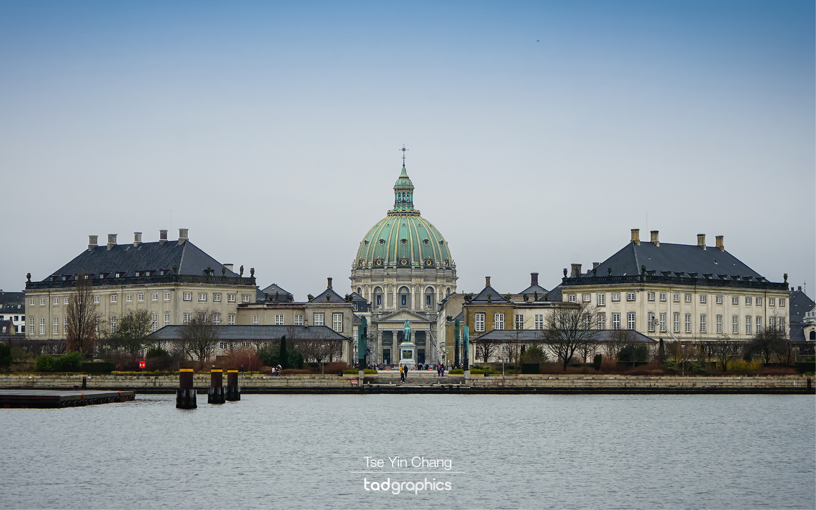
Amelienborg Palace
Amelienborg Palace consists of four identical palaces around the edge of a grand square. It was originally built for a group of noble families.

The Danish capital is often overlooked considering the famous alternatives in neighbouring countries. Images of Paris, Berlin or Amsterdam are instantly recognisable to most, yet the same cannot be said of Copenhagen. Those cities top many must visit destination lists but if you are in the area, then you should seriously consider visiting Copenhagen. It sits in the geographical and cultural gap between Scandinavia and continental Europe, and because of this it draws influences from both sides. The city and its surrounding countryside is also home to many spectacular castles, and it was these that grabbed my attention during my time in Copenhagen.
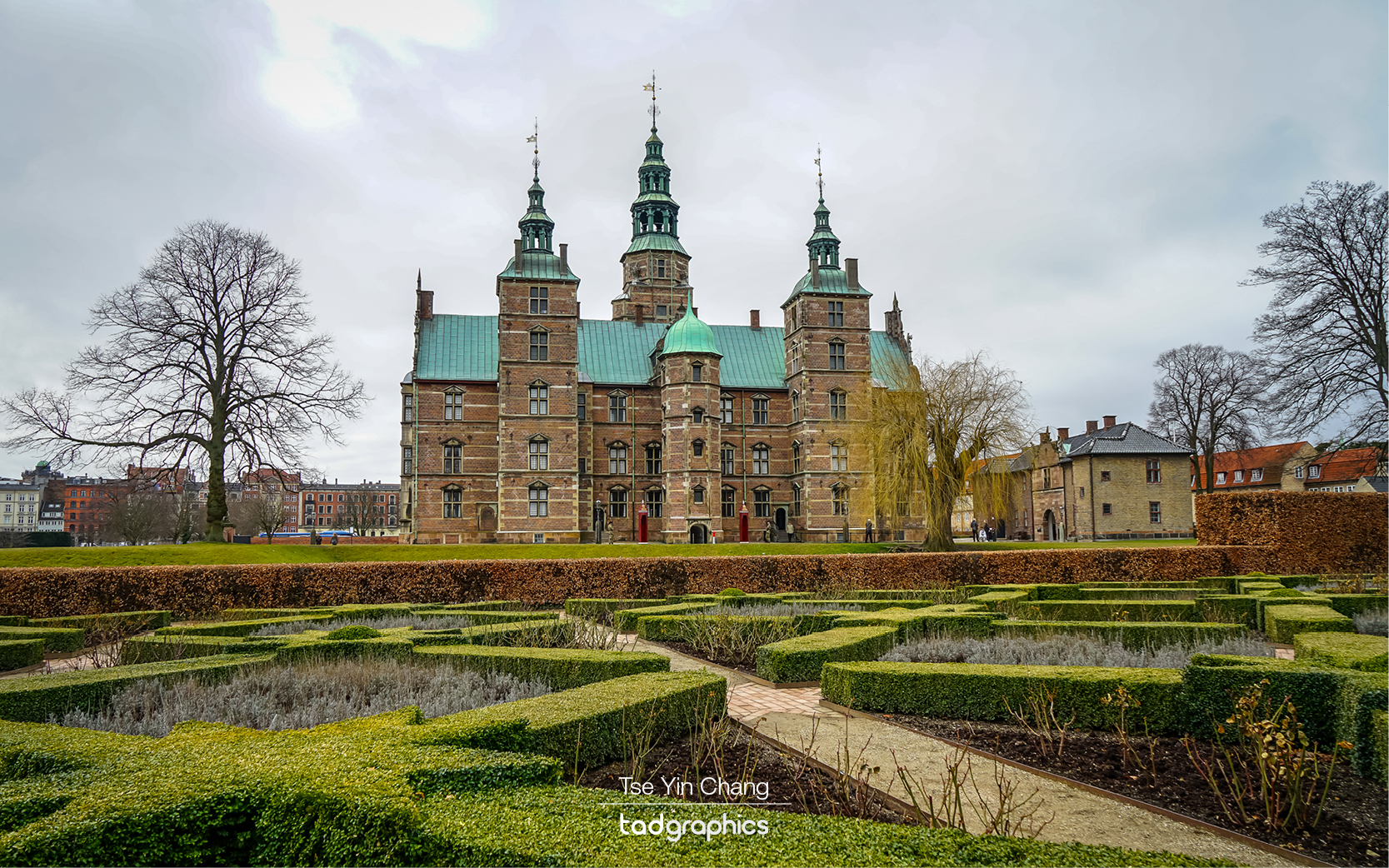
Rosenborg Castle
Rosenborg Castle houses the country’s crown jewels and throne and is surrounded by a large manicured garden

We started off with two of the most important castles in Denmark, both of which could be easily reached as they are located in the middle of the city. First up was Rosenborg, a large renaissance style palace dating back to 1606. It is a huge grand building with green copper roofs and elaborate gables. The building really drives home the wealth and power that the European monarchy had for much of history. In fact, this is a summer house and was hardly lived in. I can only imagine what it would be like having a place like this as a secondary residence.

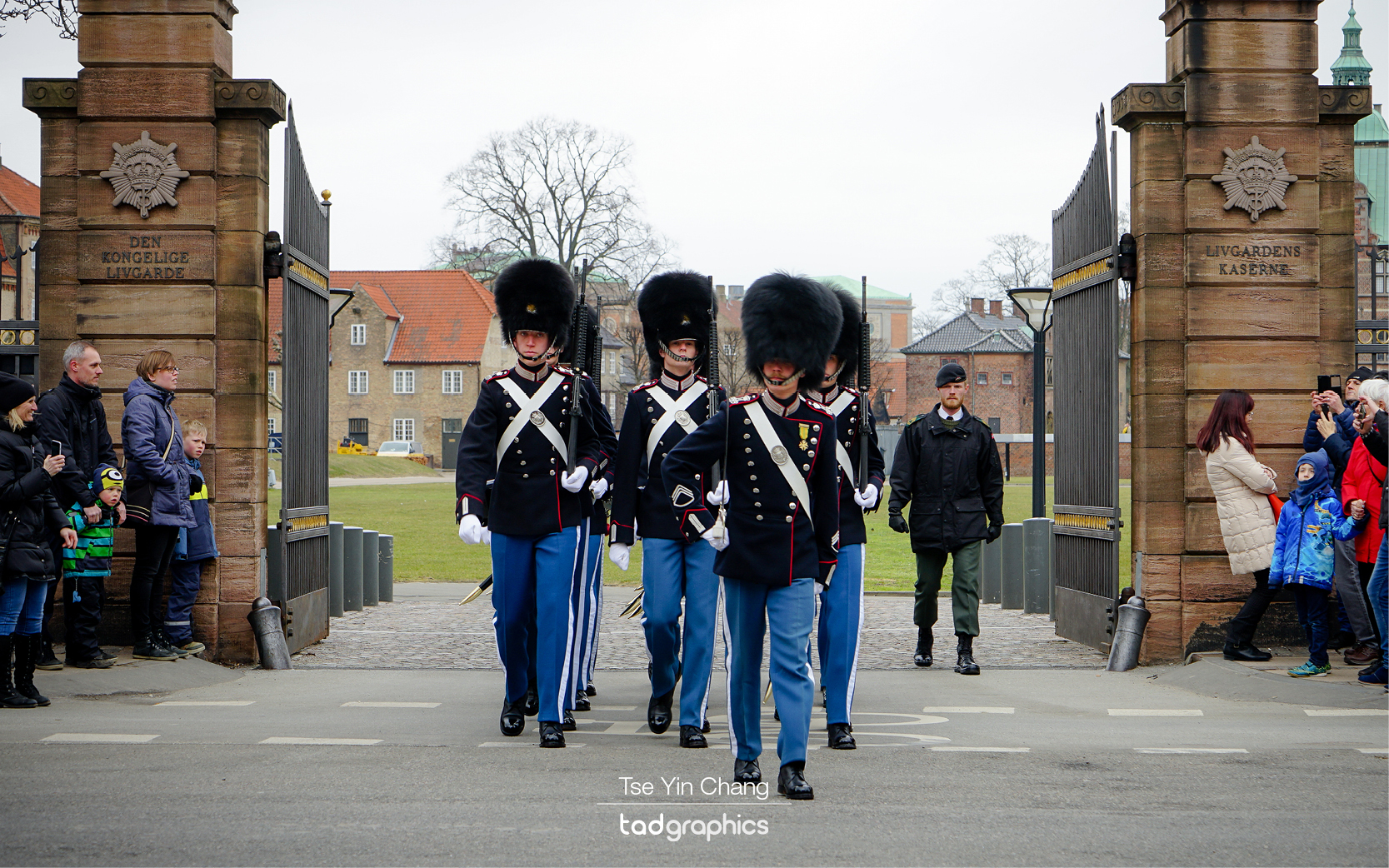
Everyday a new group of guards marches from Rosenborg Castle to the Queen’s palace to relieve those who are stationed there
Every day a new group of guards marches from Rosenborg Castle to the Queen’s palace to relieve those who are stationed there

Today it is a popular stop as it houses the country’s crown jewels and throne and is surrounded by a large manicured garden. The presence of the jewels mean that it is also the base of the Royal Life Guards – the soldiers assigned to protect the royal family. Of course, their most important job is to protect the Queen herself who resides at our second stop – Amelienborg. Every day a new group of guards marches from Rosenborg to the Queen’s palace to relieve those who are stationed there. This changing of the guard ceremony is said to be worth watching, so we followed them across the city.

Amalienborg Palace
Amalienborg Palace

Amelienborg is a bit different to your average royal palace. Consisting of four identical palaces around the edge of a grand square, it was originally built for a group of noble families. When the main royal palace burnt down in 1794, they purchased Amelienborg and various kings have chosen different sides of the square to live in ever since. Each of the buildings resembles mini-Buckingham Palaces, but there is no fence blocking access unlike Buckingham Place in London. Tourists can wander around the square and come right up to the walls of the buildings. It’s surprising that in this day and age anyone can get this close to a monarch. That said, anyone trying to get access would have to deal with the royal guards. Accompanied by a marching band, the changing of the guard ceremony demonstrated that despite their ceremonial uniforms they are still a ferocious force.

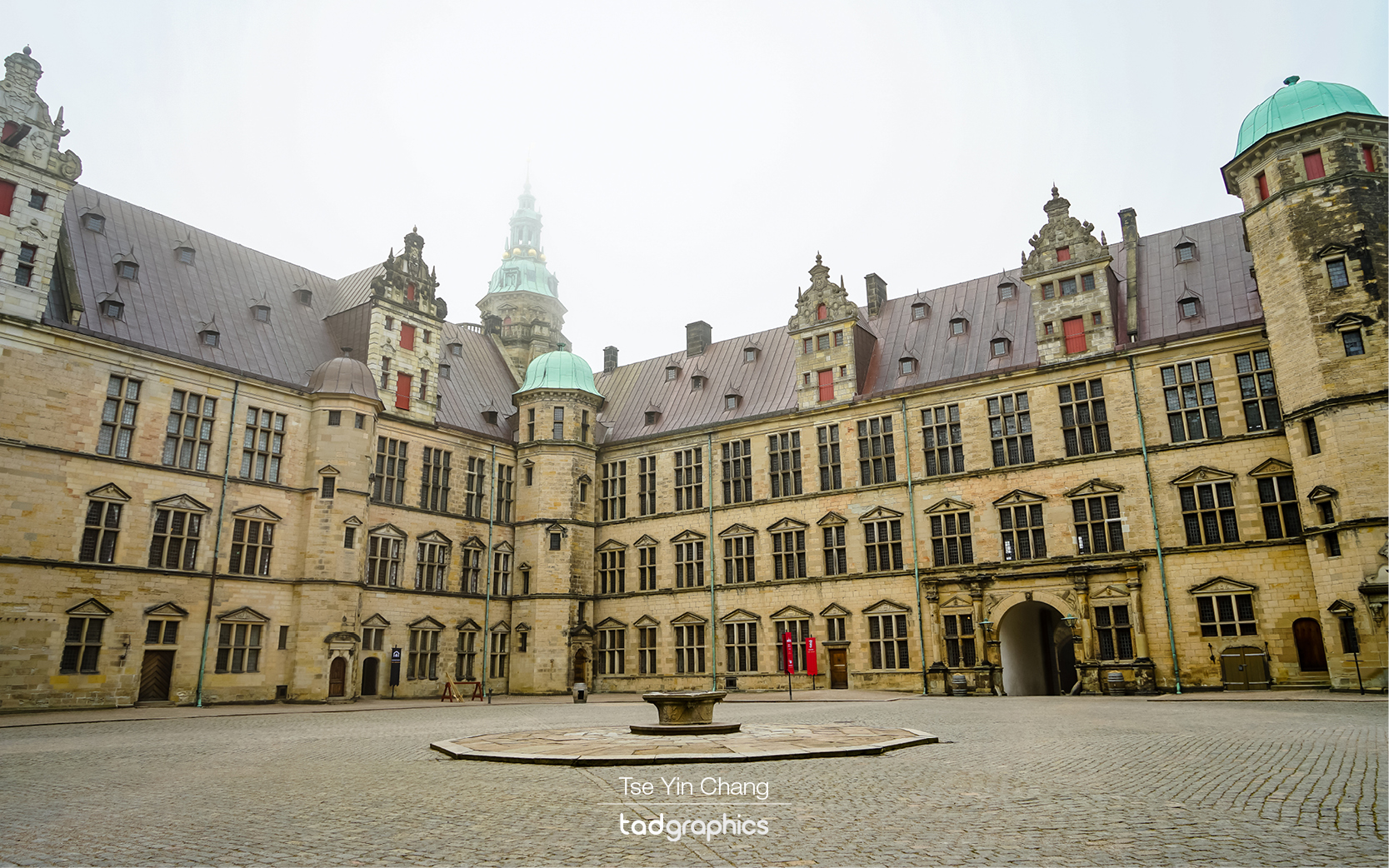
Kronborg Castle, known around the world as Hamlet's Castle
Kronborg Castle, known around the world as Hamlet’s Castle.

There were several more castles and fortifications within the city which we could have visited, however to see some of the most impressive ones you need to get out into the countryside. Situated just a stone’s throw across the water from Sweden, Kronborg has long been one of Denmark’s most strategically important castles. Its position not only allowed troops stationed there to keep an eye on their neighbours, but also to block the strait and control access to and from the Baltic Sea. They used to charge all passing ships a toll, which helped fund the Danish state.

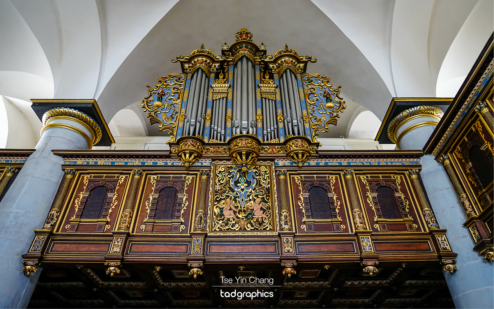
An impressive pipe organ found inside the Chapel in Kronborg Castle

Its importance must have been recognised internationally, because Shakespeare chose Kronborg Castle as the setting for one of his most famous works – Hamlet. Although it is obviously fictional, there is something exciting about being within the same walls that the famous ‘to be or not to be’ speech was supposed to have been made. The UN have also recognised Kronborg by making it a UNESCO world heritage site. They did so for the building itself, as much as for its role in history, as it is a beautifully designed place. Internally it is palatial and comfortable, externally its star shaped walls and moat prove that it had a real military use.

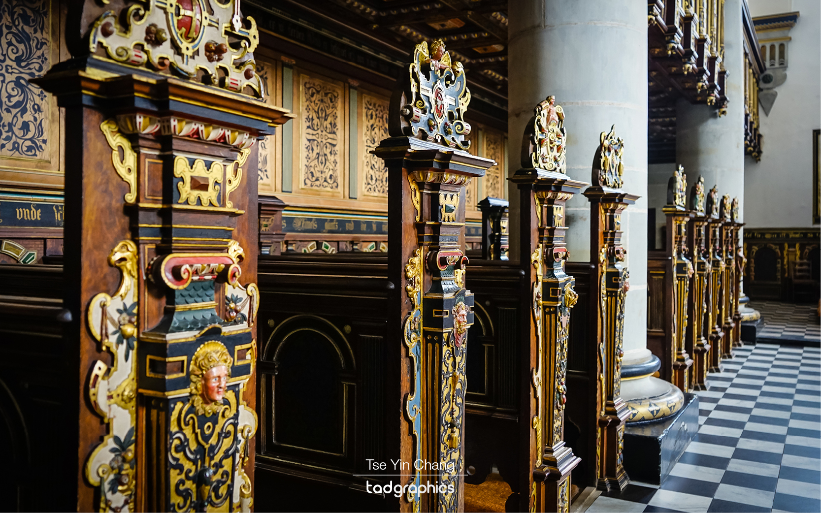
The pews topped with a painted headpiece found inside the Chapel in Kronborg Castle is unique and depicts various aspects of the royal coat of arms and religious figures and symbols.
The pews topped with a painted headpiece found inside the Chapel in Kronborg Castle are unique and depicts various aspects of the royal coat of arms and religious figures and symbols.

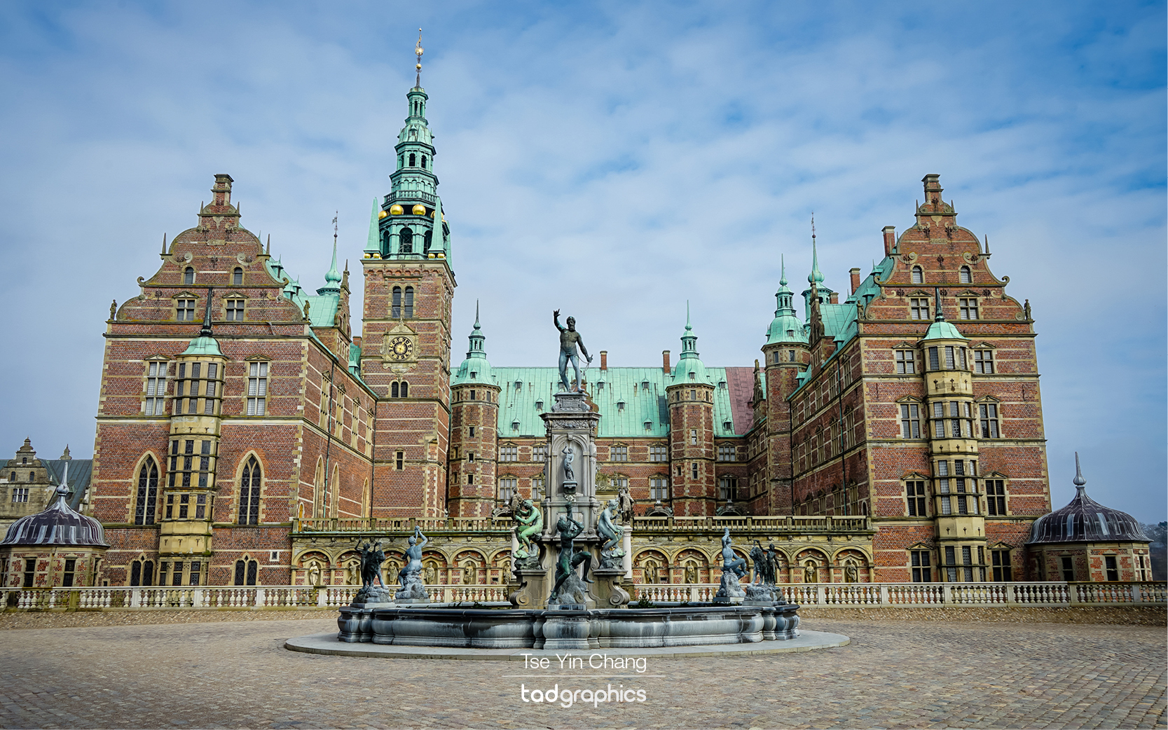
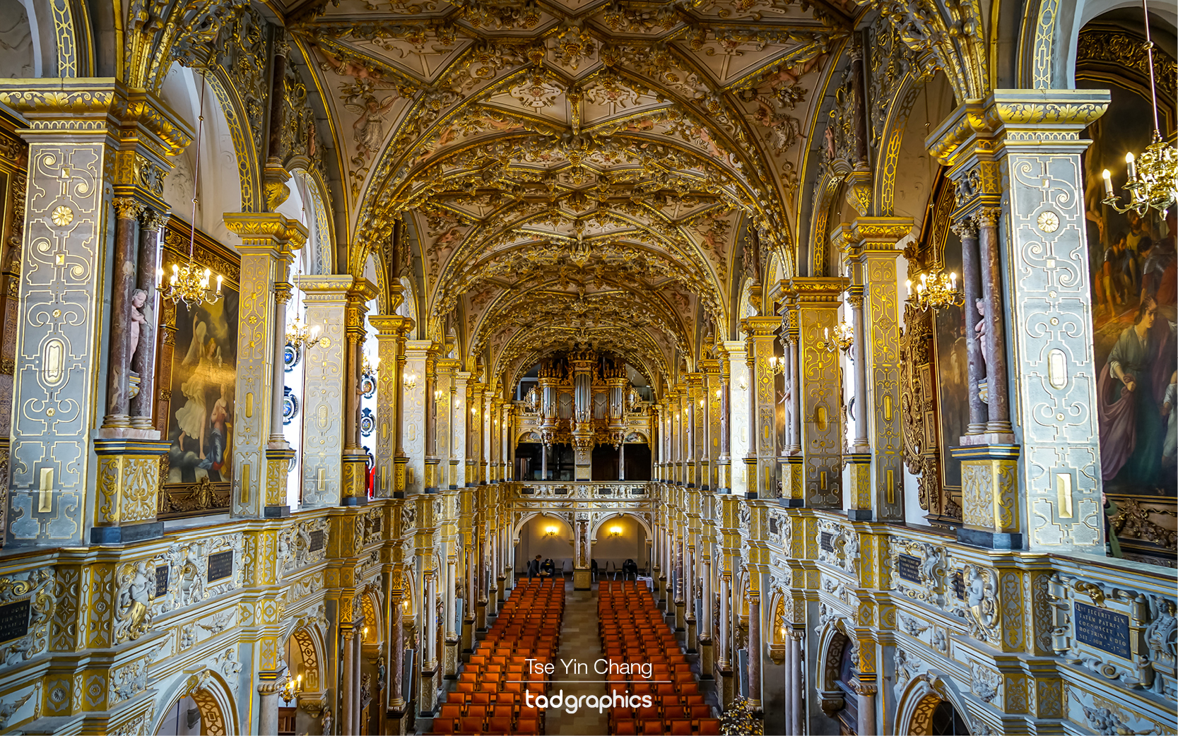
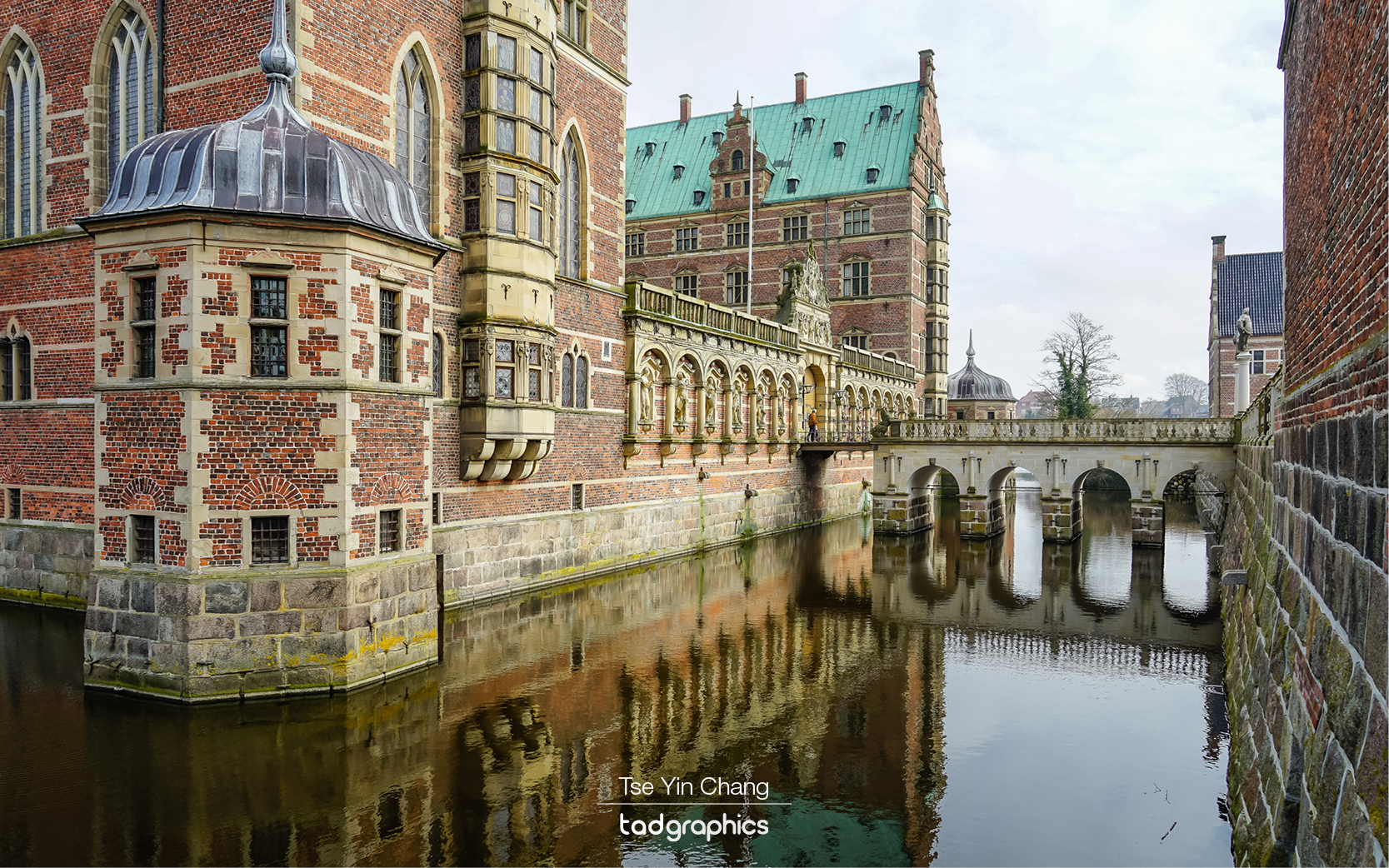
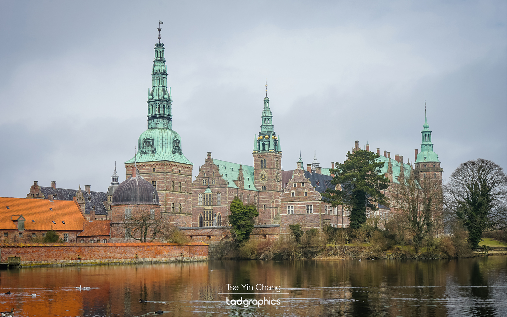
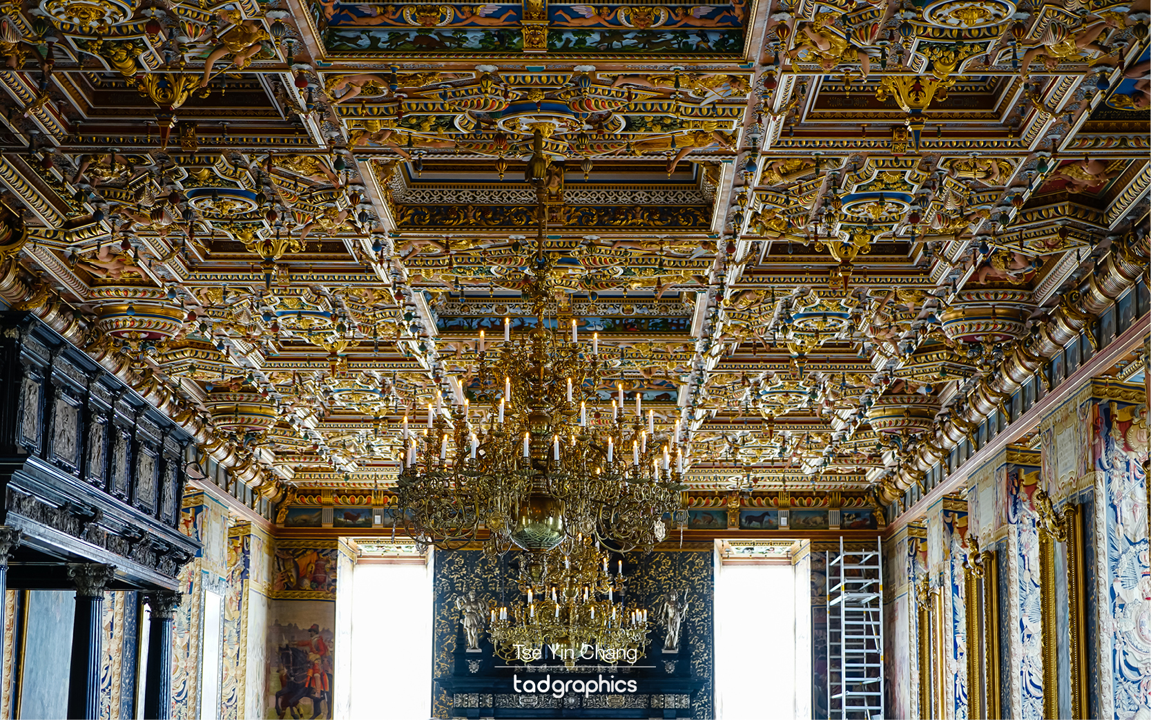
Next we took a short trip inland to the city of Hillerød. Here sits Frederiksborg Palace, the largest and most beautiful of the renaissance style palaces in Scandinavia. Unlike Kronborg this was definitely not built for defensive purposes, and instead was another place for the king to retreat to if he wanted to get out of Copenhagen. Inside it is one of the most decorative buildings I have ever seen, with every inch of wall and floor covered in paintings or elaborate stucco work. It is also home to Denmark’s natural history museum and a set of vast landscaped gardens.

Frederiksborg Palace, also known as the Nordic Versailles is the largest and most beautiful of the renaissance style palaces in Scandinavia
Frederiksborg Palace, also known as the Nordic Versailles is the largest and most beautiful of the renaissance style palaces in Scandinavia.

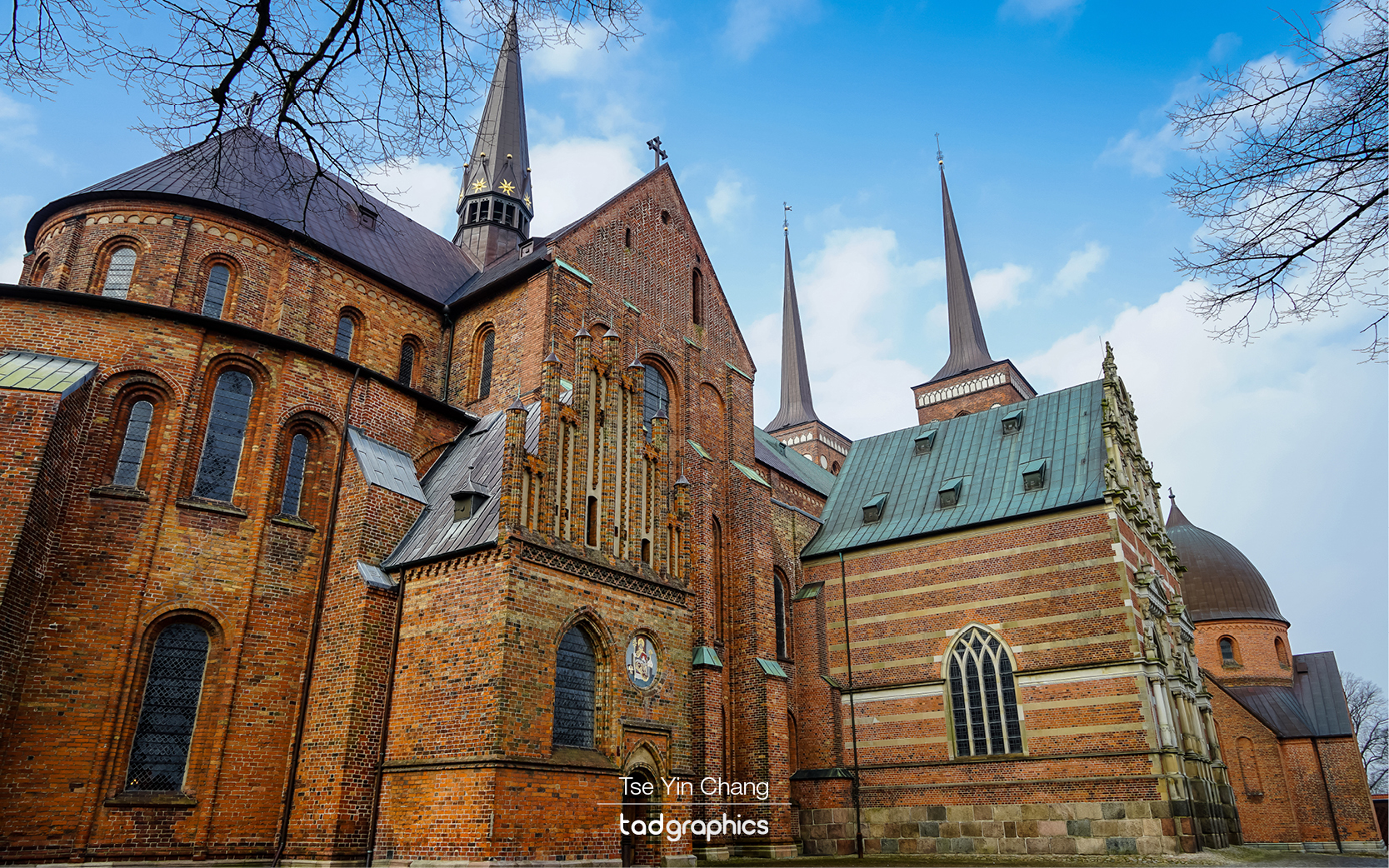
If Frederiksborg stood out for its ornateness, our final stop was notable for the opposite. Roskilde Cathedral is the country’s most important religious building, and although it certainly has the size to match its status, its design is remarkably austere. Its main body is made from plain red bricks and it lacks the flowery design features associated with many churches built during the same era. Somehow that doesn’t make it any less impressive however, and its two spires dominate the surrounding area. It was also our second UNESCO world heritage site of the day.

The impressive Chapel in Frederiksborg Castle is the best preserved part of the Renaissance complex

This cathedral is where the royal family have been buried since the 1400s. There is in fact, nowhere in the world with more kings and queens buried in one place. This has meant that extensions have been built over the centuries to make room for all the royal bodies, and each one is in a different architectural style. The latest addition is outside, and only dates back to 1985 when King Frederik the ninth was interned. We spent some time wandering around, appreciating the size of the space and just how many tombs there are.

Roskilde Cathedral is the country’s most important religious building where the royal family have been buried here since the 1400s

We spent the rest of our time there visiting the city’s other attractions. Despite it being early spring at the time of our trip, we were lucky enough to get snow on our last two days there. This added to the atmosphere and made the city even more memorable. When our time was up we made our way to the airport, and caught a flight to our next destination – Amsterdam.

Amelienborg Palace at night
The Frederiksborg Palace is situated on three islets in the Slotssøen (castle lake)
The Frederiksborg Castle built by King Christian IV in the early decades of the 17th century incorporates the best of Renaissance architecture and craftsmanship
Opulence ceiling panels with numerous carved and painted figures in the Great Hall (Riddersalen). It is the largest room in Frederiksborg Castle.
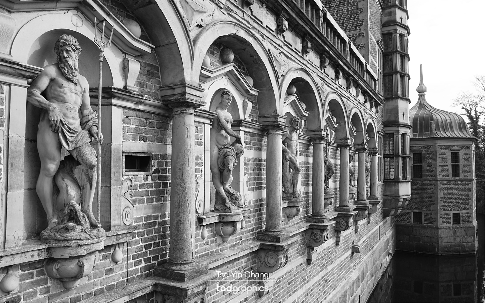
Sculptures in Arcade at Frederiksborg Castle

Filed Under: Blog, Photography, Portfolio, Travel Tagged With: Amelienborg, castle, copenhagen, denmark, europe, Frederiksborg, Kronborg, photography, Roskilde, travel, UNESCO

© Copyright 2005-26. All rights reserved. t ad studio | tad graphics. Web and graphic design Perth. Admin